Actually, there were four more lines that needed to be edited in codecolorer-core.php to make the CodeColorer plugin work for PHP 7.
To make it easier for other people, below is the code in its entirety.
Actually, there were four more lines that needed to be edited in codecolorer-core.php to make the CodeColorer plugin work for PHP 7.
To make it easier for other people, below is the code in its entirety.
I updated the PHP version that my website uses to PHP 7. I ran into two problems:
If you notice anything else, please let me know.
I still have a Samsung Galaxy S4. It’s old and slow, the (second) battery is bad, and the magnetometer is probably completely broken, but at least it doesn’t explode. And it’s paid off.
For the last few months, however, I’ve had the problem that the Galaxy S4 “forgets” that it has a SIM card inserted, necessitating a reboot. This got so bad that it only lasted a few minutes between reboots. Heat and movement seemed to make it worse.
I tried something similar to what was suggested in this blog post: i wedged a folded up sticky note between the phone, just above the battery, and the back. My case holds it nicely in place.
I don’t want to jinx it, but in the last five days, my phone hasn’t crashed. After fixing the USB connector, yet another win over planned obsolescence!
Here are a few more pictures from our scramble to Putrid Pete’s Peak, Webb, and Mount Defiance. Fellow Mountaineer Barb took these pictures.
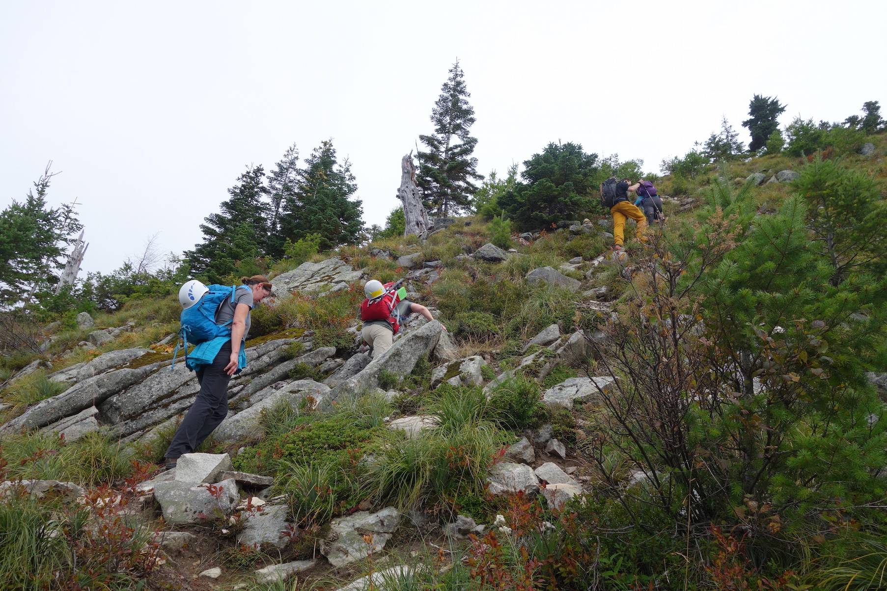
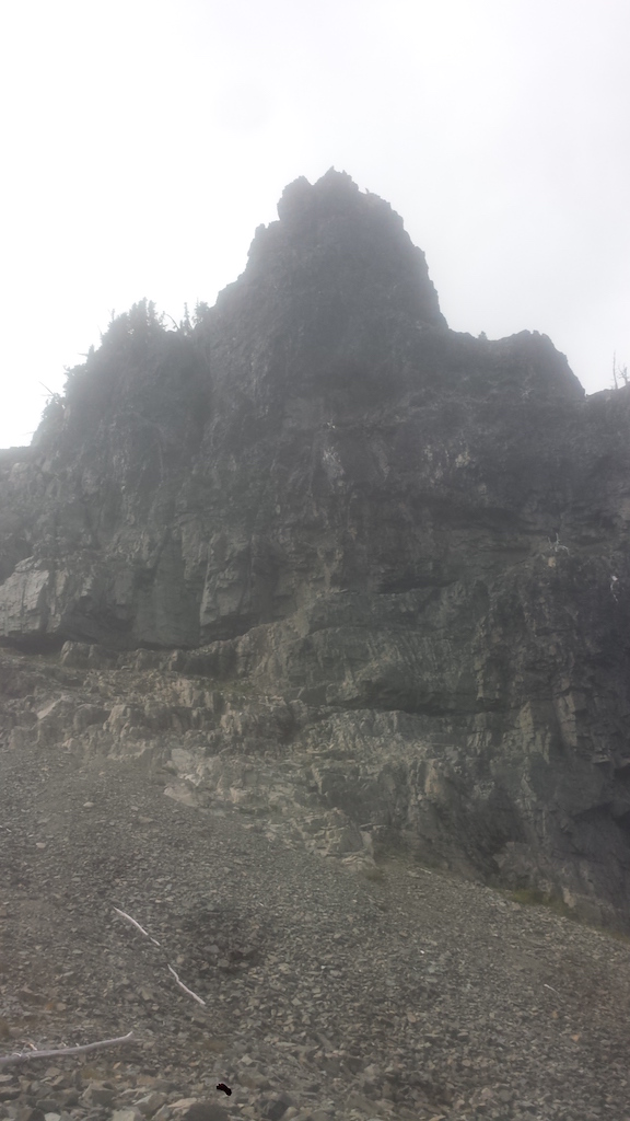
Scrambling up towards Putrid Pete’s.
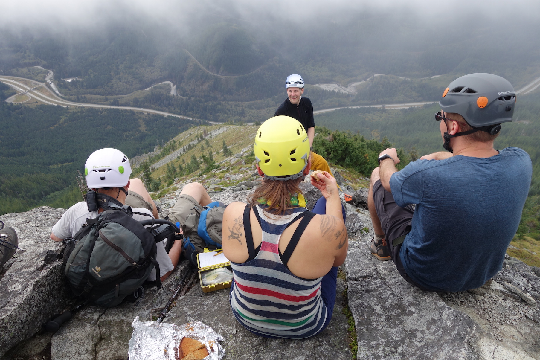
On the summit of Putrid Pete’s Peak, high above I-90.
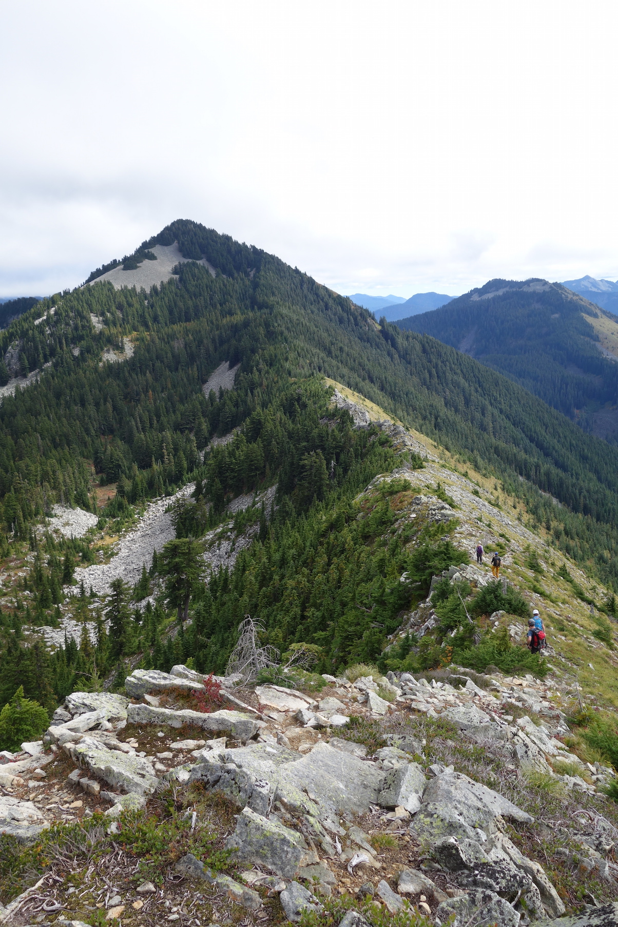
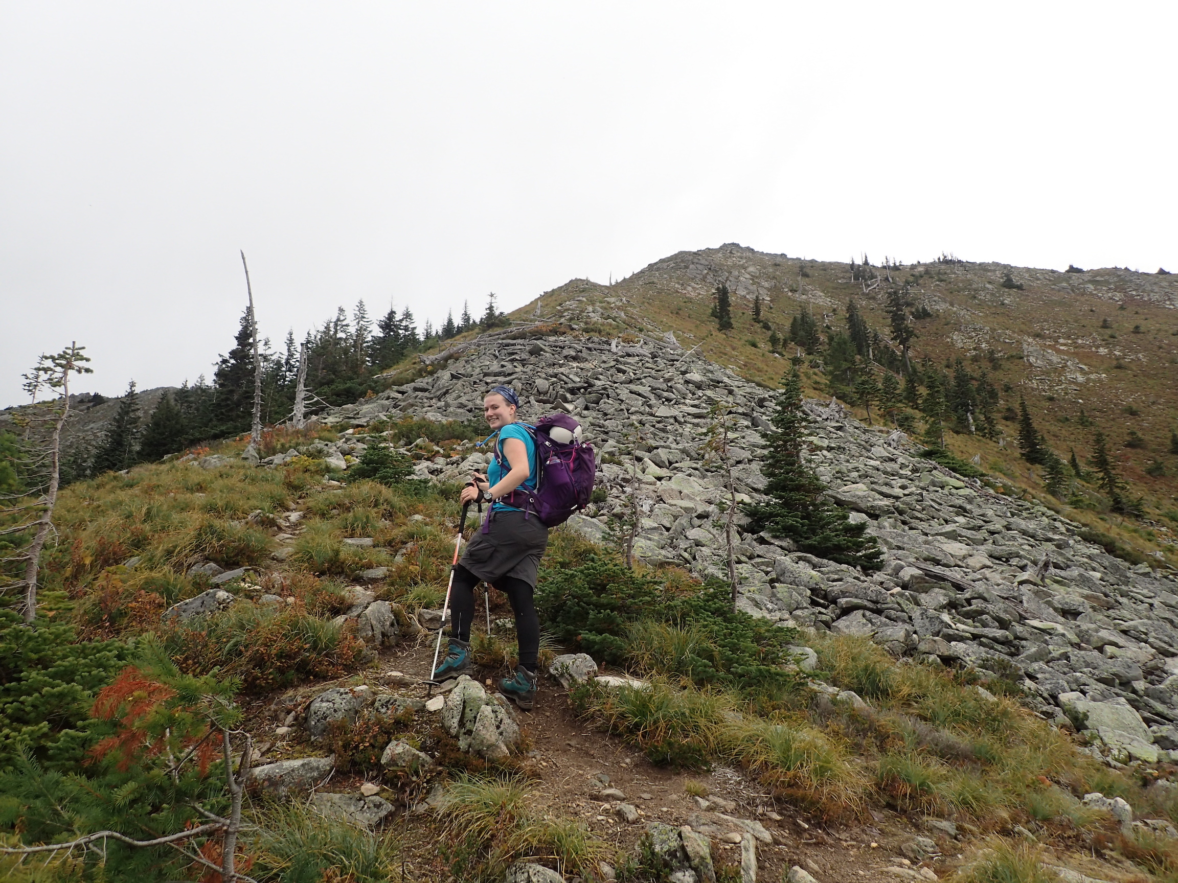
Running the ridge to Mount Defiance.
On the Mount Defiance trail
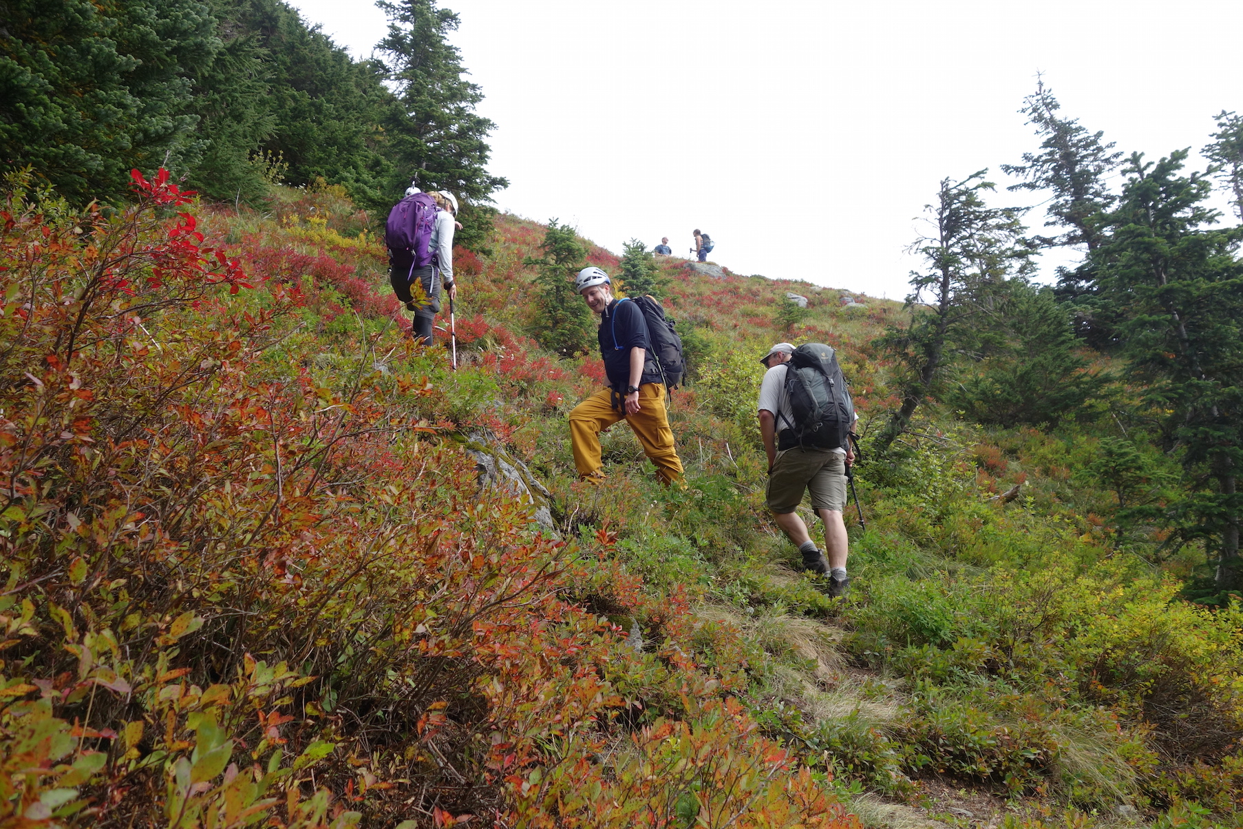
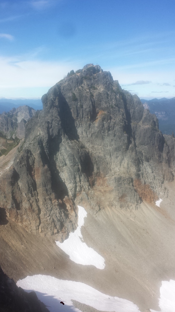
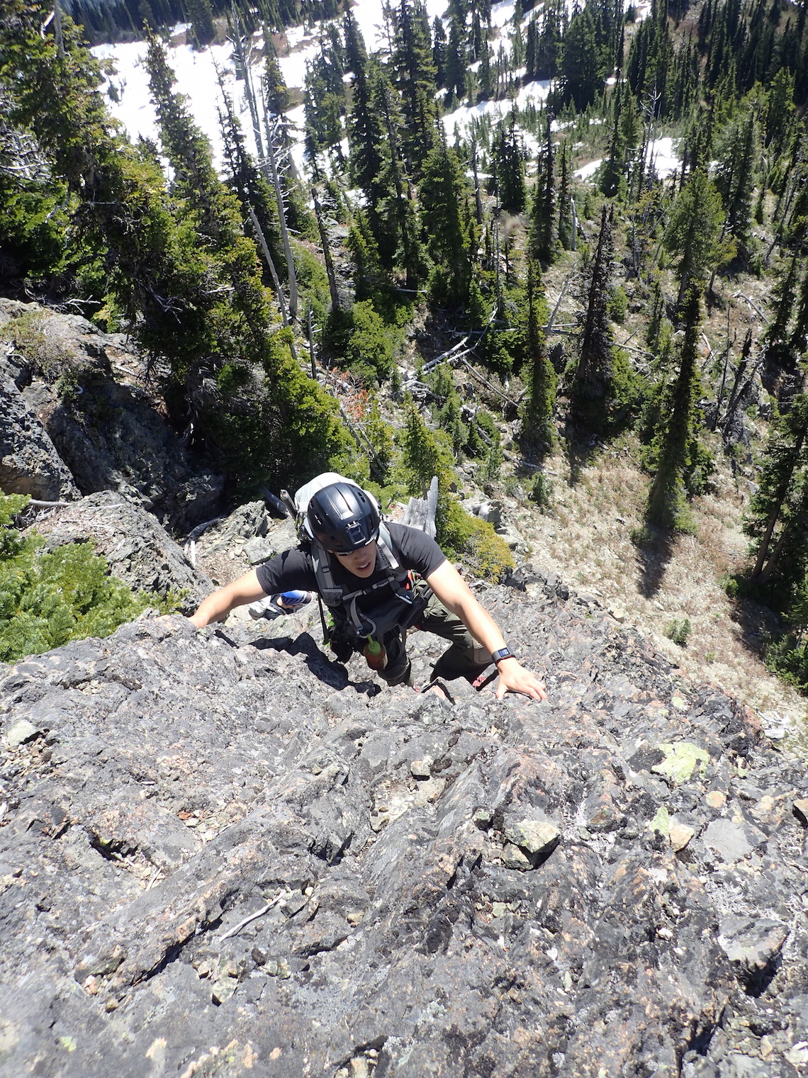
On Sunday, Jenny and I joined a 10-mile Mountaineers scramble to three peaks along the I-90 corridor. We ascended to Putrid Pete’s Peak, then scrambled to the west to Web Mountain, came back to Putrid Pete’s, ascended the ridge to just below Mount Defiance, and hiked up to the summit of Mount Defiance. We took the easy Mount Defiance trail back to the trailhead.

Hiking up above the I-90 corridor.
Scrambling up towards Putrid Pete’s Peak.
On top of Putrid Pete’s Peak.
Scrambled west to Web Mountain.
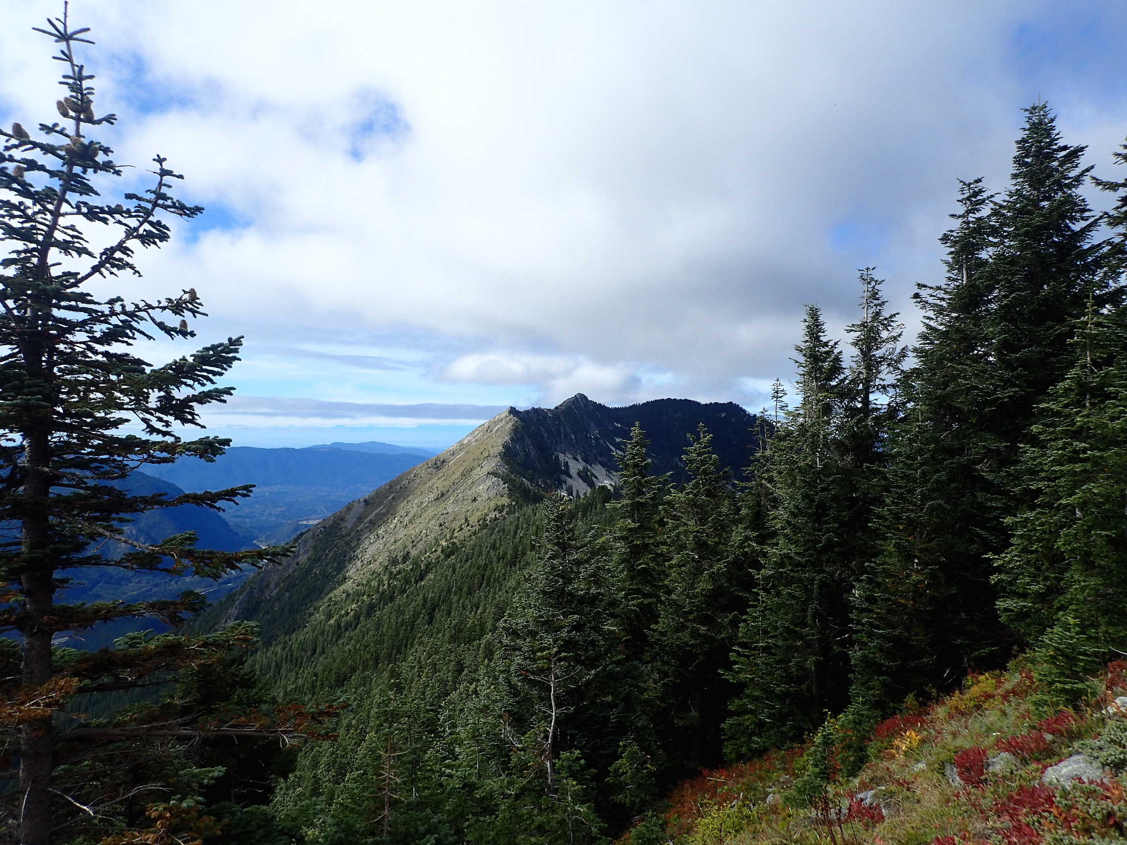
From just below Mount Defiance, we could see the ridge we had just traversed from Putrid Pete’s.
On Mount Defiance. Views were great.
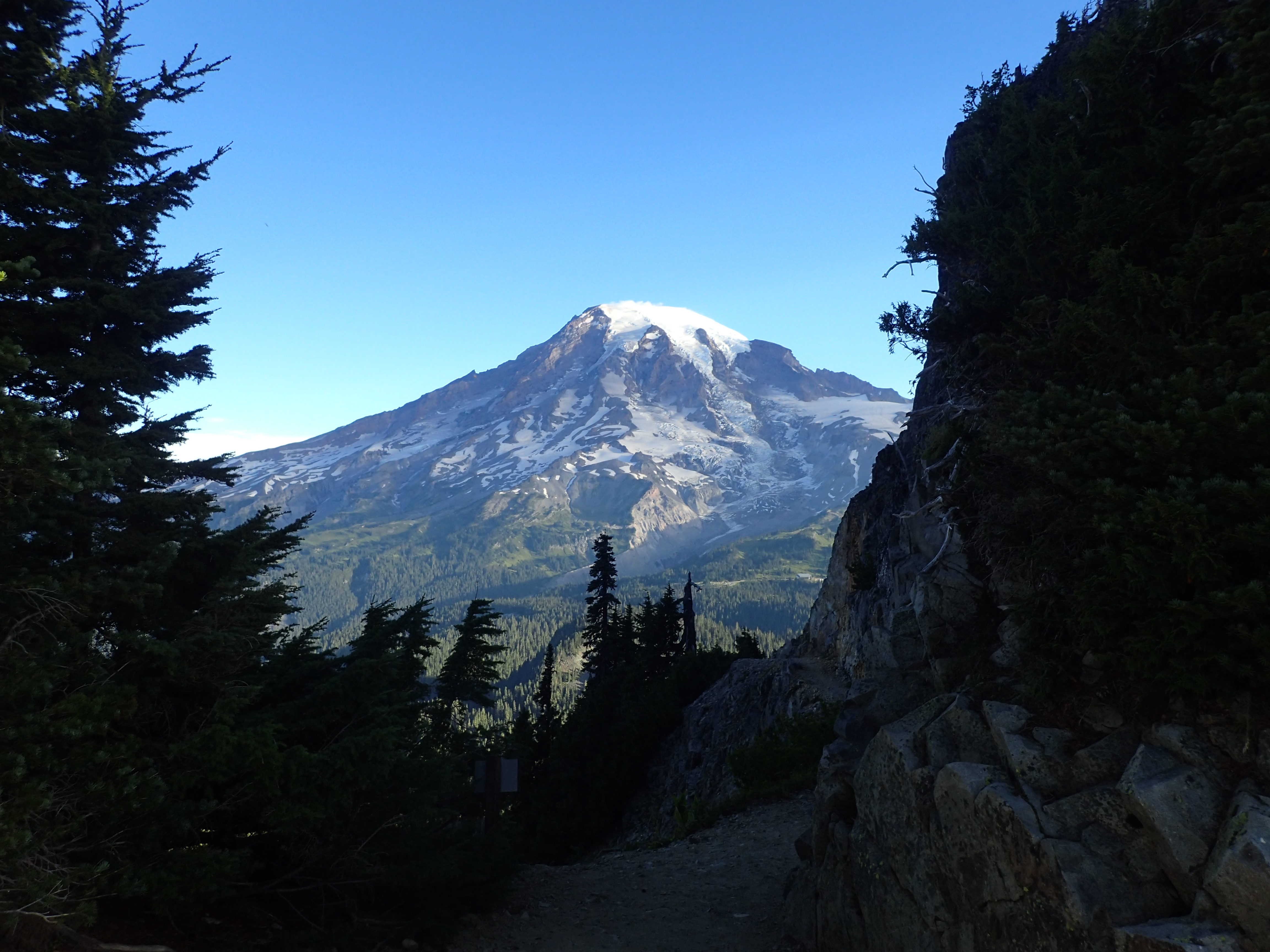
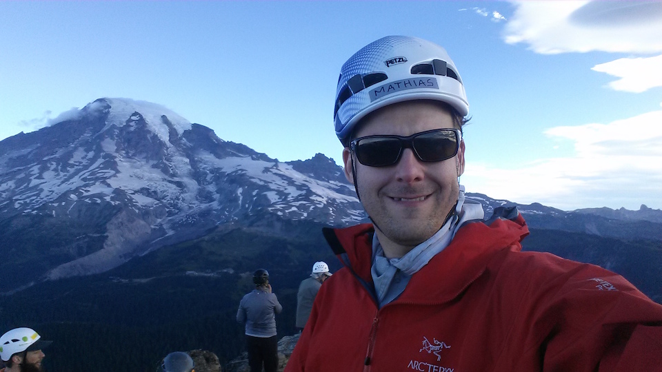
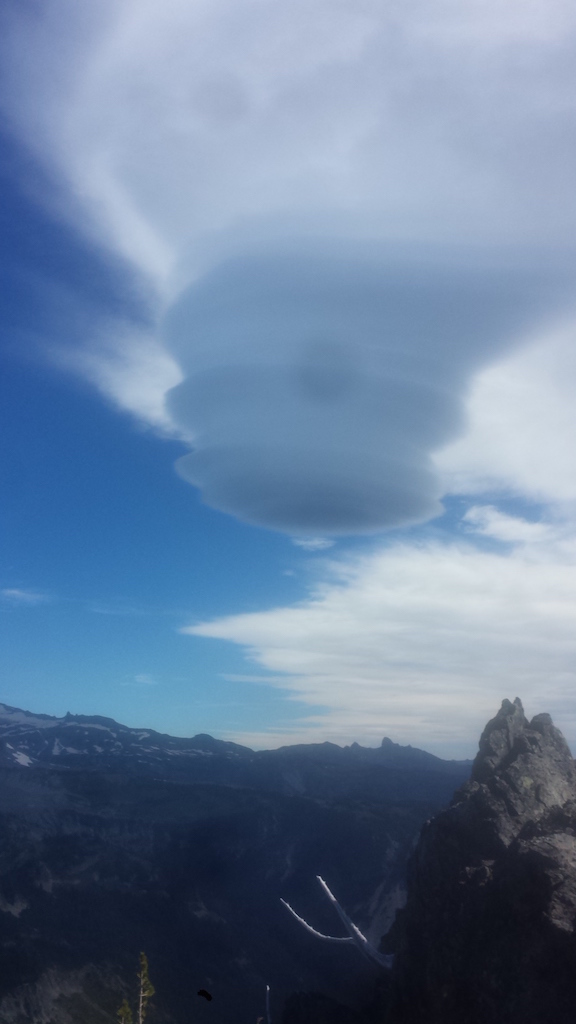
I found another picture of Mount Rainier from the Pinnacle and Castle climb, and I just absolutely love the way the light falls on the mountain. It looks like a painting.
My Olympus camera stopped working five pictures into the climb, and I had to switch to my phone’s camera. Hopefully just a battery issue.
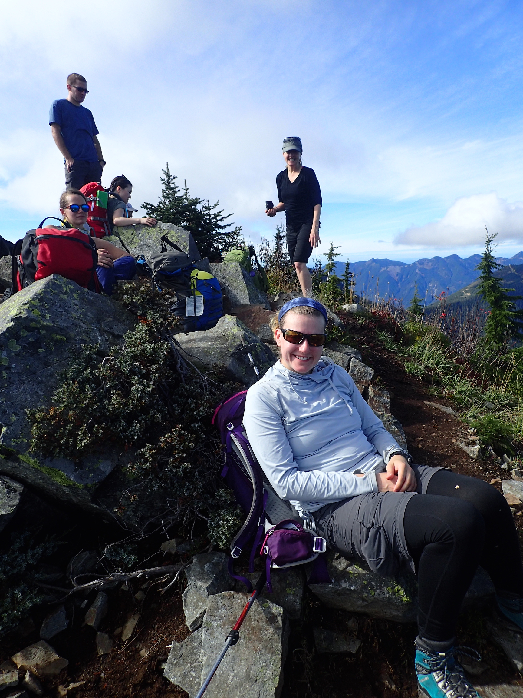
Here are a few more pictures of the Pinnacle Peak and The Castle climb, courtesy of Julie and Stephen, and our route, recorded by Ben.

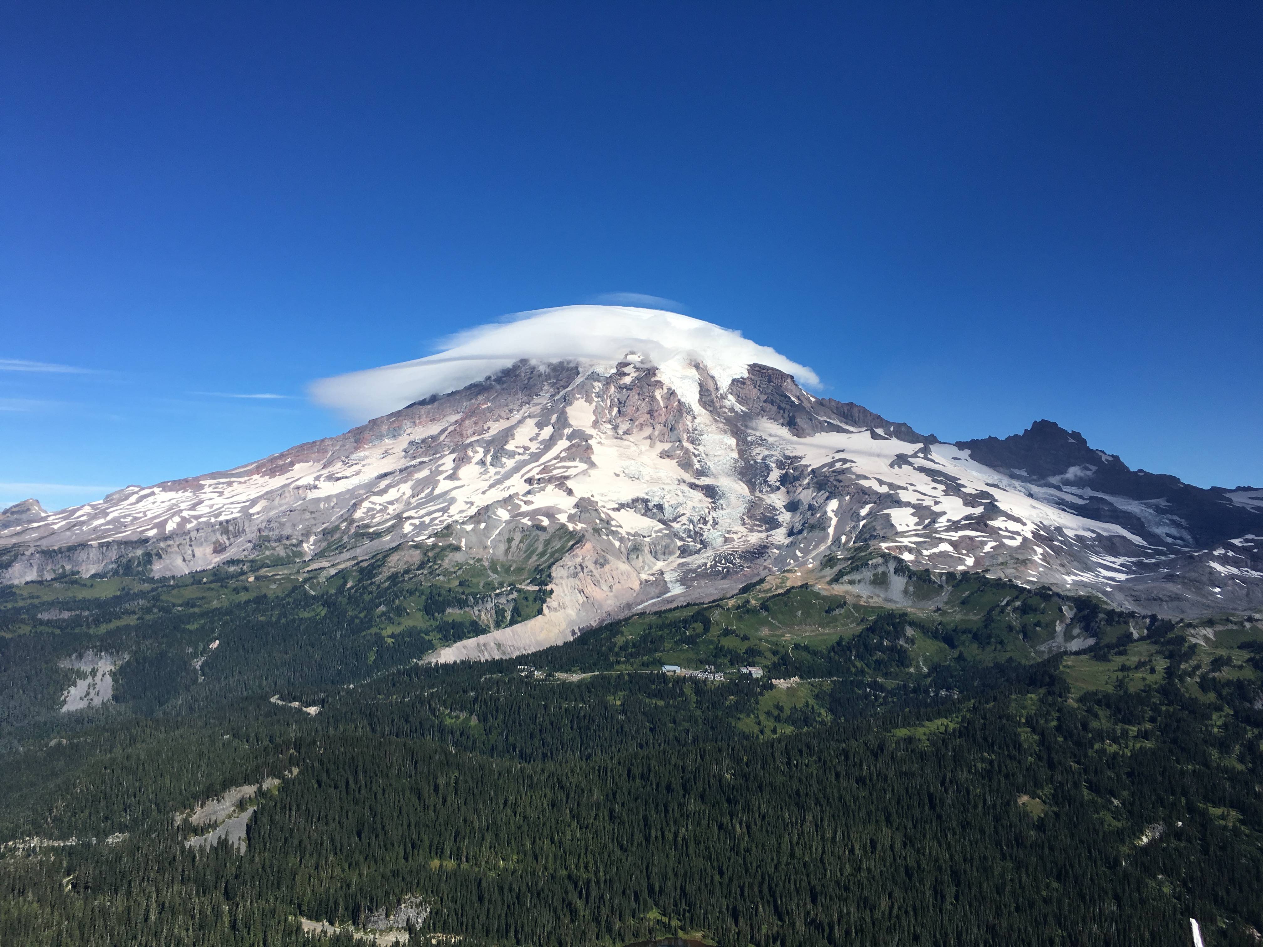
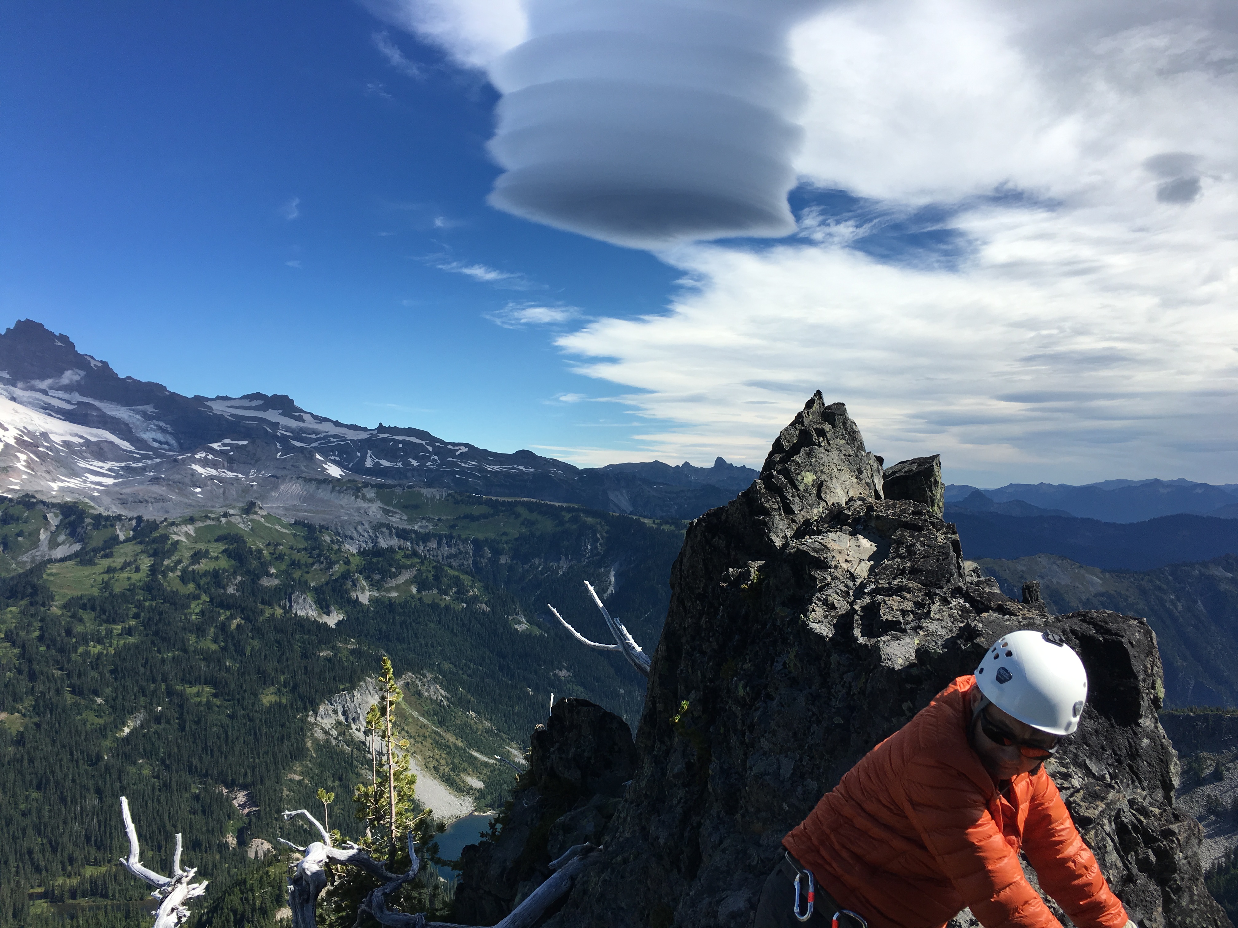
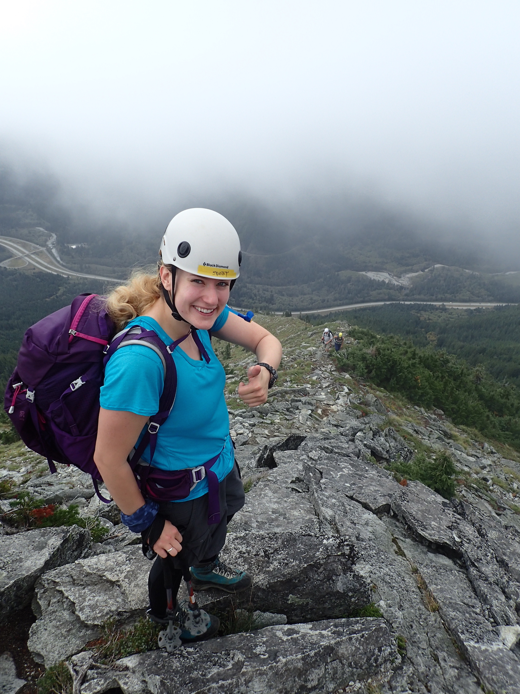
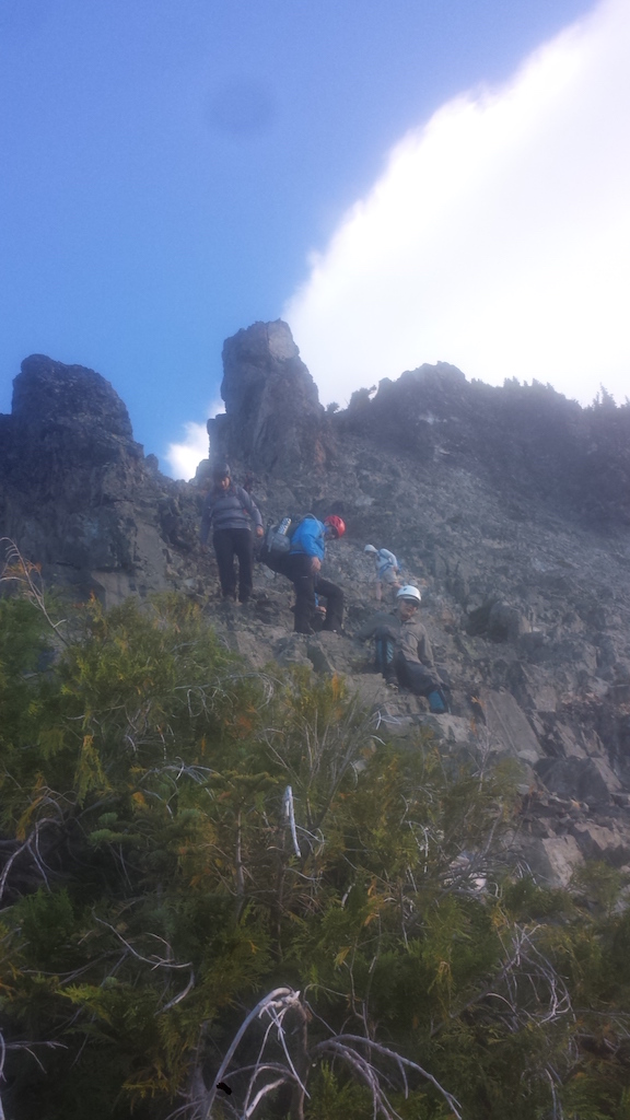
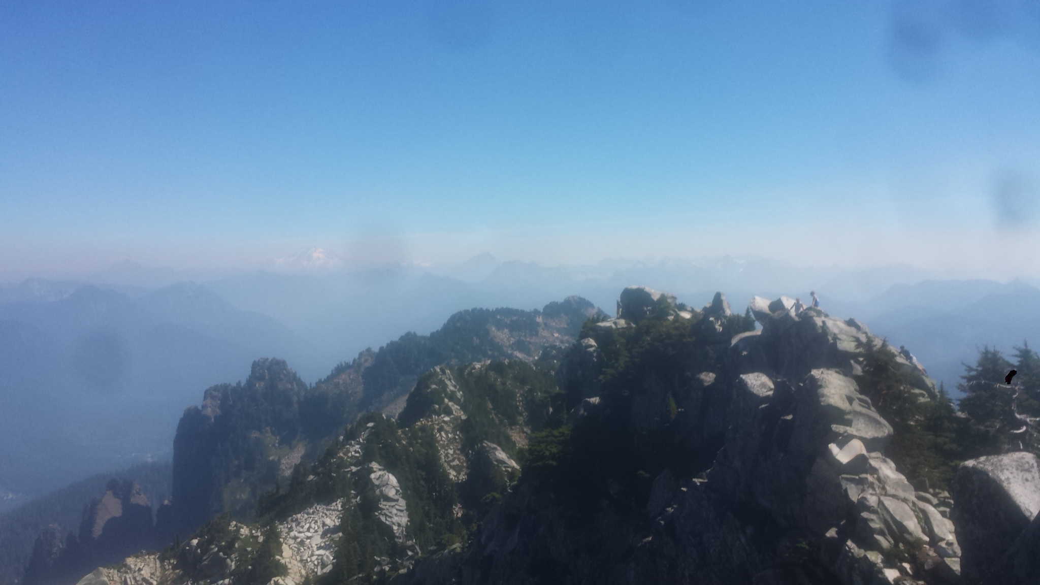
Together with a group of Mountaineers, I climbed Pinnacle Peak and The Castle in the Tatoosh range south of Mount Rainier. This was our second attempt, after getting so close to Pinnacle Peak in June.
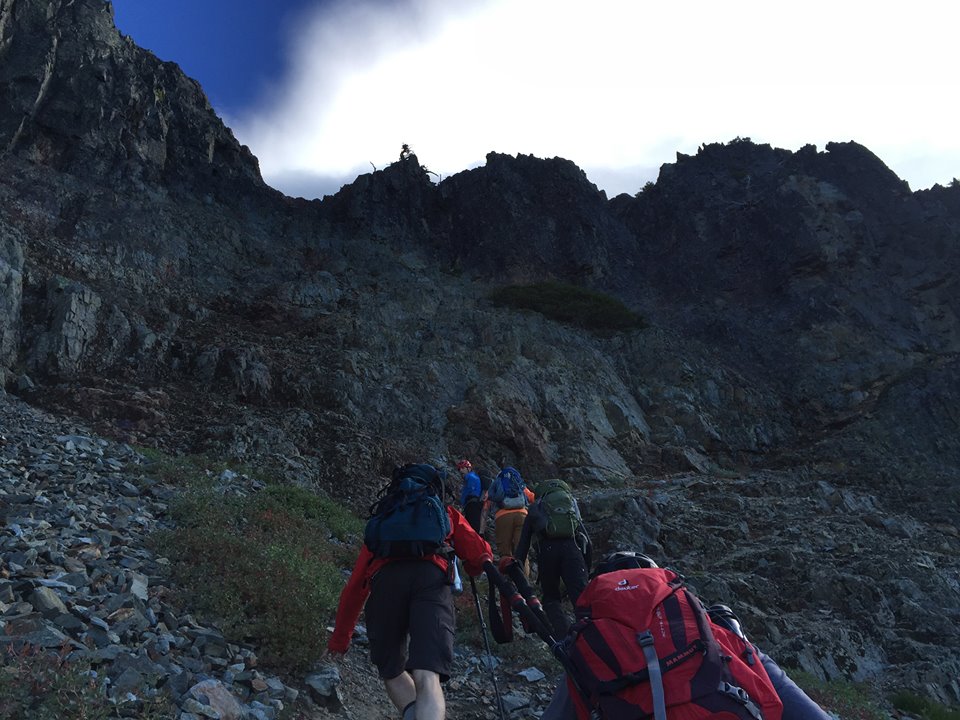
The summer trail was a lot easier than the winter approach, although it was probably a bit longer to get to Pinnacle Peak. We scrambled up on the southwestern side, and there was only a short section that was a bit difficult. Downclimbing for the most part was easy too.
The Castle, which we hadn’t even looked at in June, was a lot of fun. We approached from the south and scrambled over a ridge. From there, we could get to the East face. It was an easy climb with, I believe, two pieces of protection. Most of us prusiked up on a handline. After that, an easy rappel down the same way.
We returned a slightly different way, that was parallel to the winter route and rejoined the main trail close to the road.
One of the most exciting parts of the vista were the clouds. We saw a very strange cloud with multiple lenticular formations, and watched as a lenticular cloud developed and slowly engulfed most of Mount Rainier.


One of our climbs got cancelled, so Jenny and I were looking for something else we could do on a Saturday. We found a Mountaineers maintenance trip to the Mount Pilchuck lookout. I had been there in 2015, but Jenny had not.
We didn’t need a stewardship activity, we graduated already, but it was a nice hike in the sun. From the lookout, we could see Baker and Shuksan, Glacier Peak, Rainier, and also Sloan Peak, “the Matterhorn of the Cascades”, which Jenny had just summited. And by maintaining the lookout, it became “our lookout.”
Here are the three videos I shot while climbing Mount Adams.
On the summit:
Descending below Pikers Peak:
Forest fire damage:
With the WTA Northwest Exposure 2016 photo contest coming up, here are the five pictures I’ve taken in 2016 that I like the best:
Unicorn Peak:
Whistler Mountain:
Mount Adams summit:
Mount Rainier, from the summit of Mount Adams:
Scrambling up Cathedral Rock:
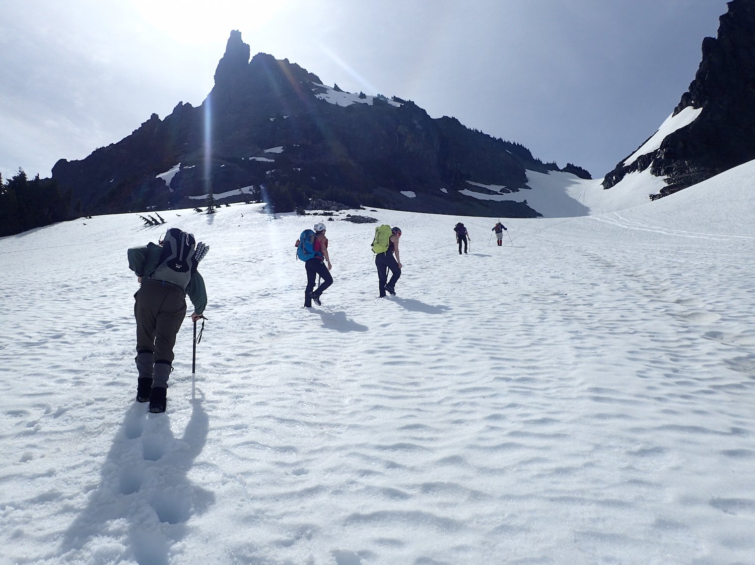
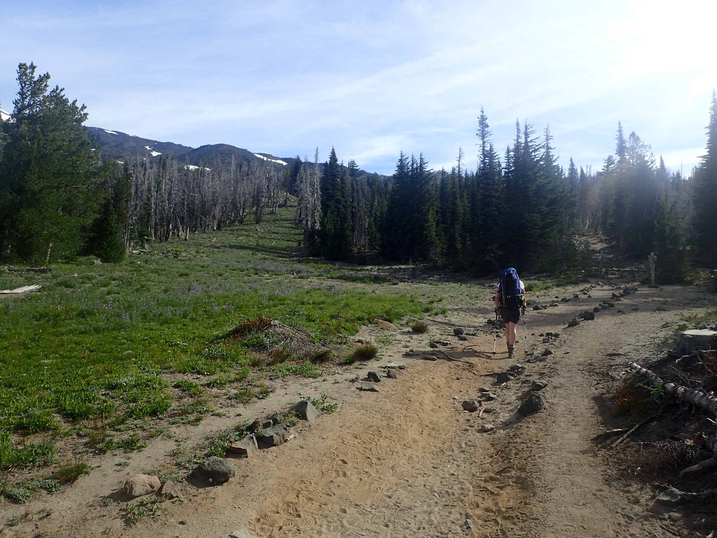
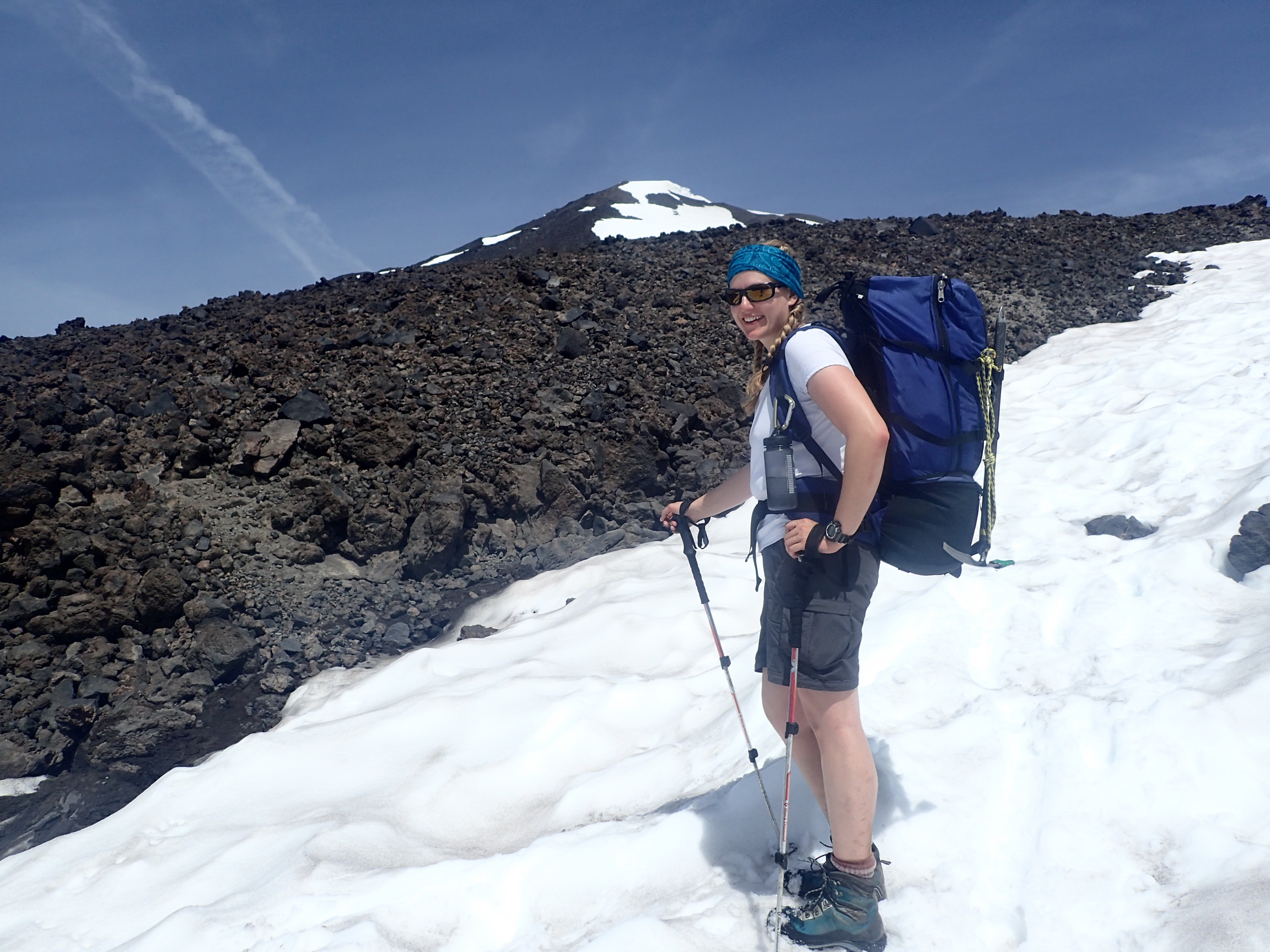
Friday evening we drove out to Hood River, OR, where we stayed at a hotel for a last night in a bed and a gear check. Saturday morning, we ate warm breakfast, drove to the Ranger Station in Trout Lake and self-issued climbing permits. By 8:30, we were at the trailhead, which was quite packed with cars. The last mile of the road was quite rough for my Toyota Camry.
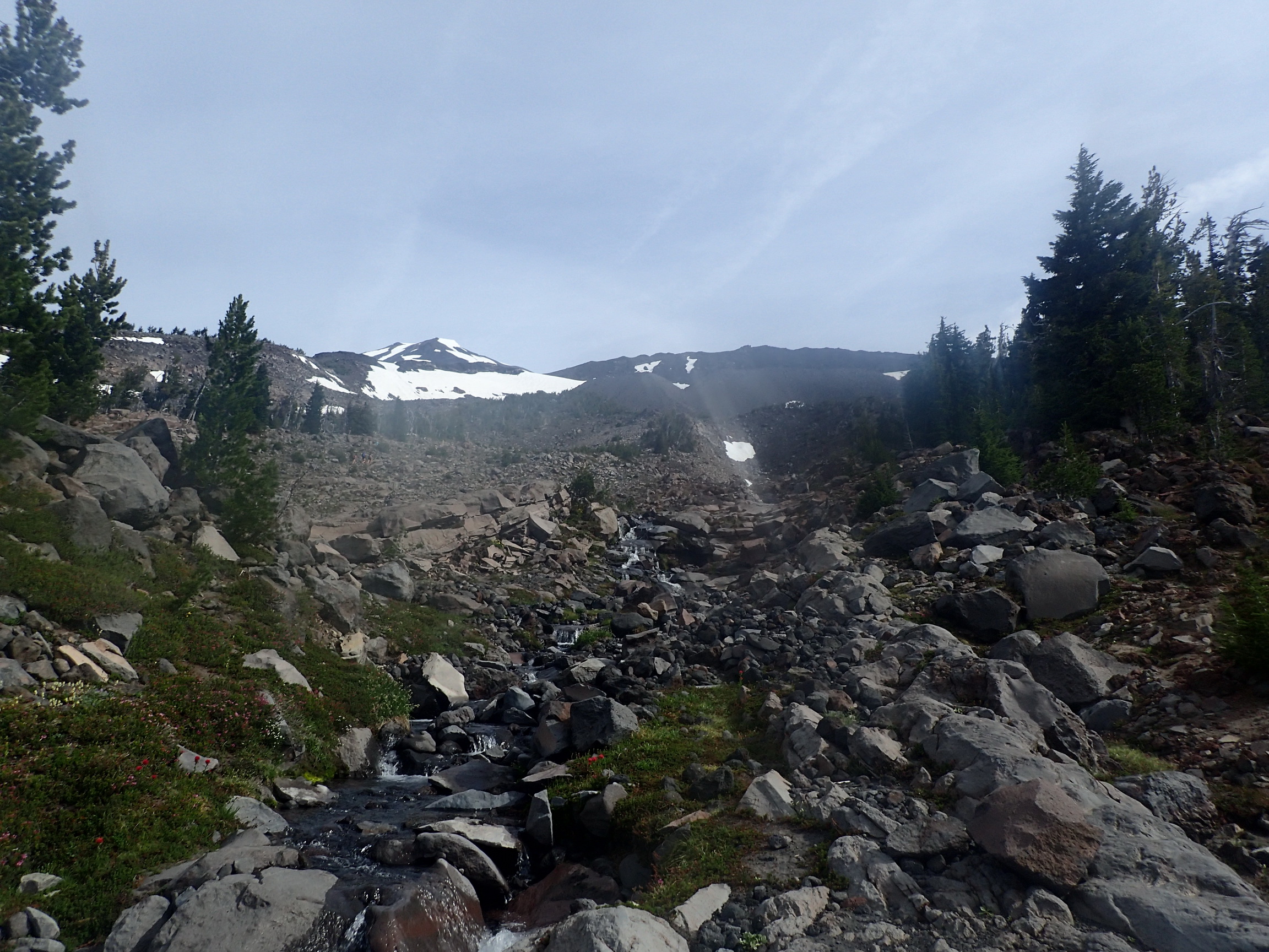
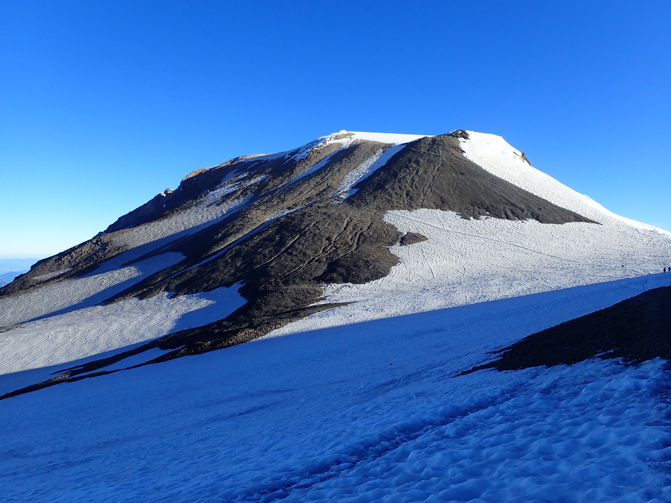
We started hiking on Saturday at about 9 AM and 5500 feet elevation. There was very little shade because of the wildfire last year. We crossed Morrison Creek at about 6800 feet elevation, but weren’t in need of water yet. We just dipped our hats in the water for a quick refreshment. We reached the first bit of contiguous snow at about 7250 feet elevation, at the southern edge of the Crescent Glacier. Since the snow was rather slushy already, we opted to stay on the rocks and do a bit of a scramble to the west instead of ascending directly on the snow.
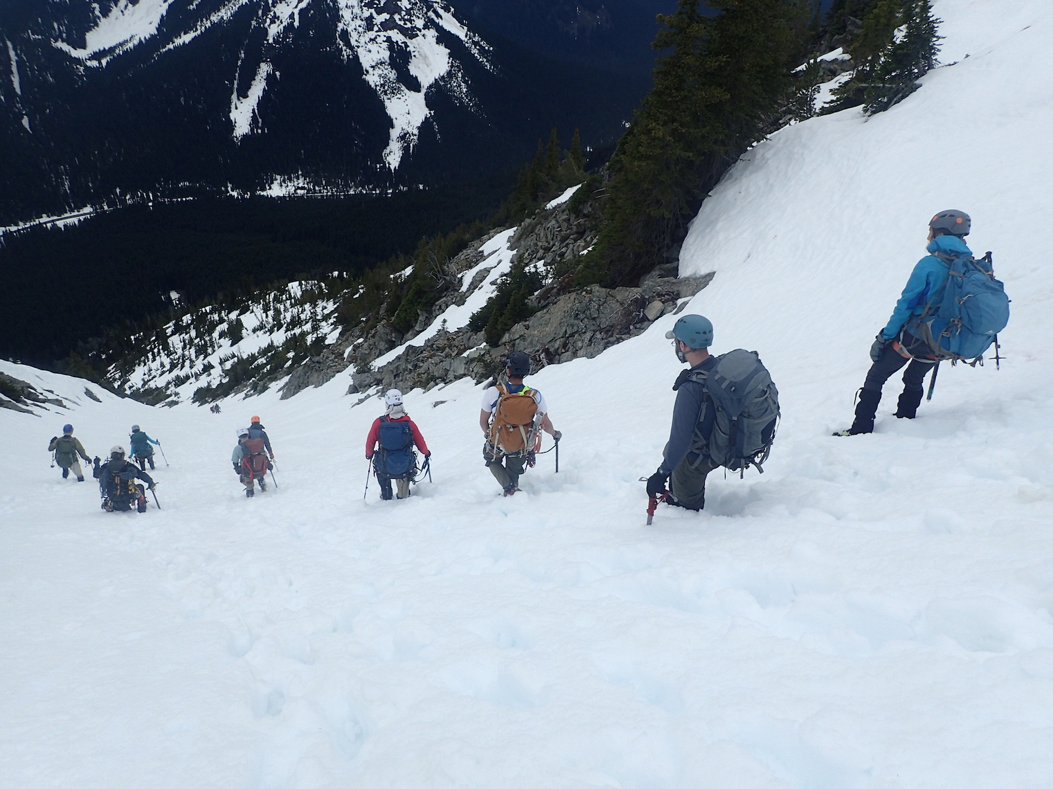
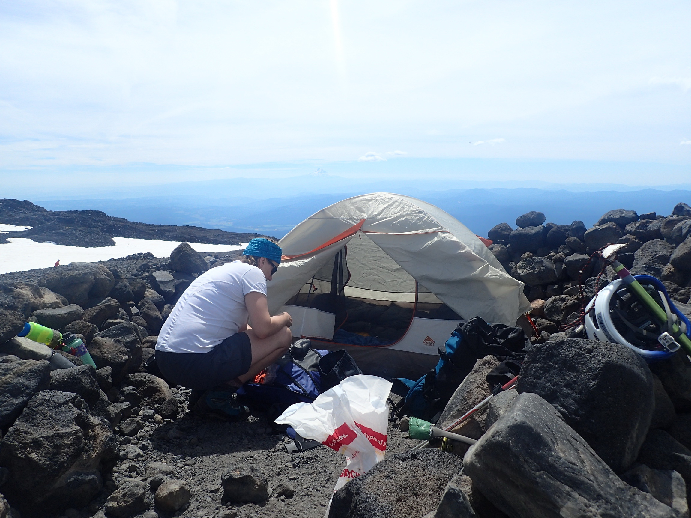
At about 8500 feet elevation, we switched to the snow and more or less angled directly to the waypoint I had set for the Lunch Counter. We got to our camp site just before 1 PM. The camp site was at 9400 feet elevation, which is higher than Jenny had ever been. I had been at slightly above 10000 feet, but only for a few minutes. There were plenty of available camp sites encircled by rock walls, and we picked a fantastic one at the northeastern edge of the Lunch Counter, just feet from running water and the snow field that we would have to ascend at night. We cooked food and rested.
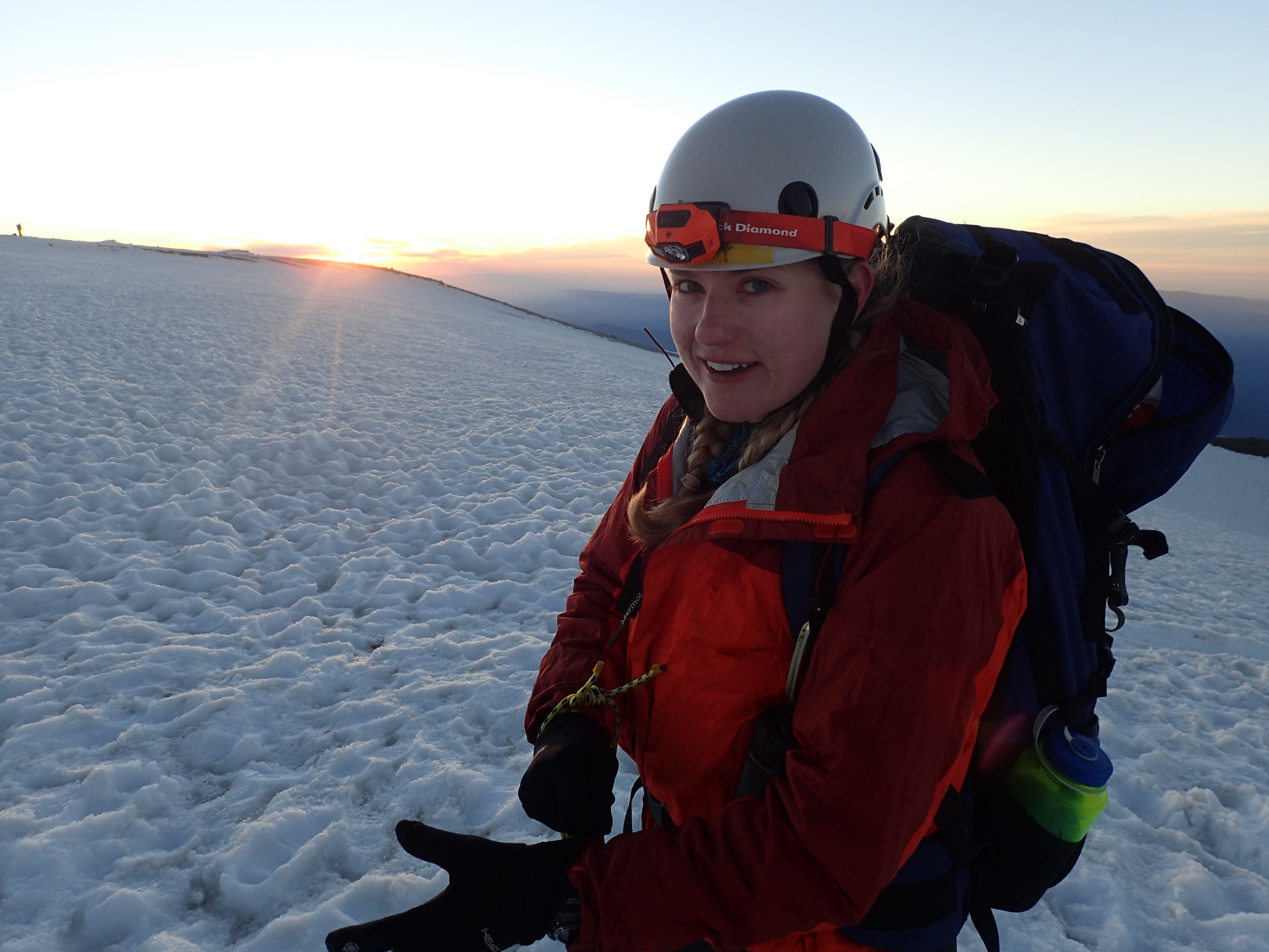
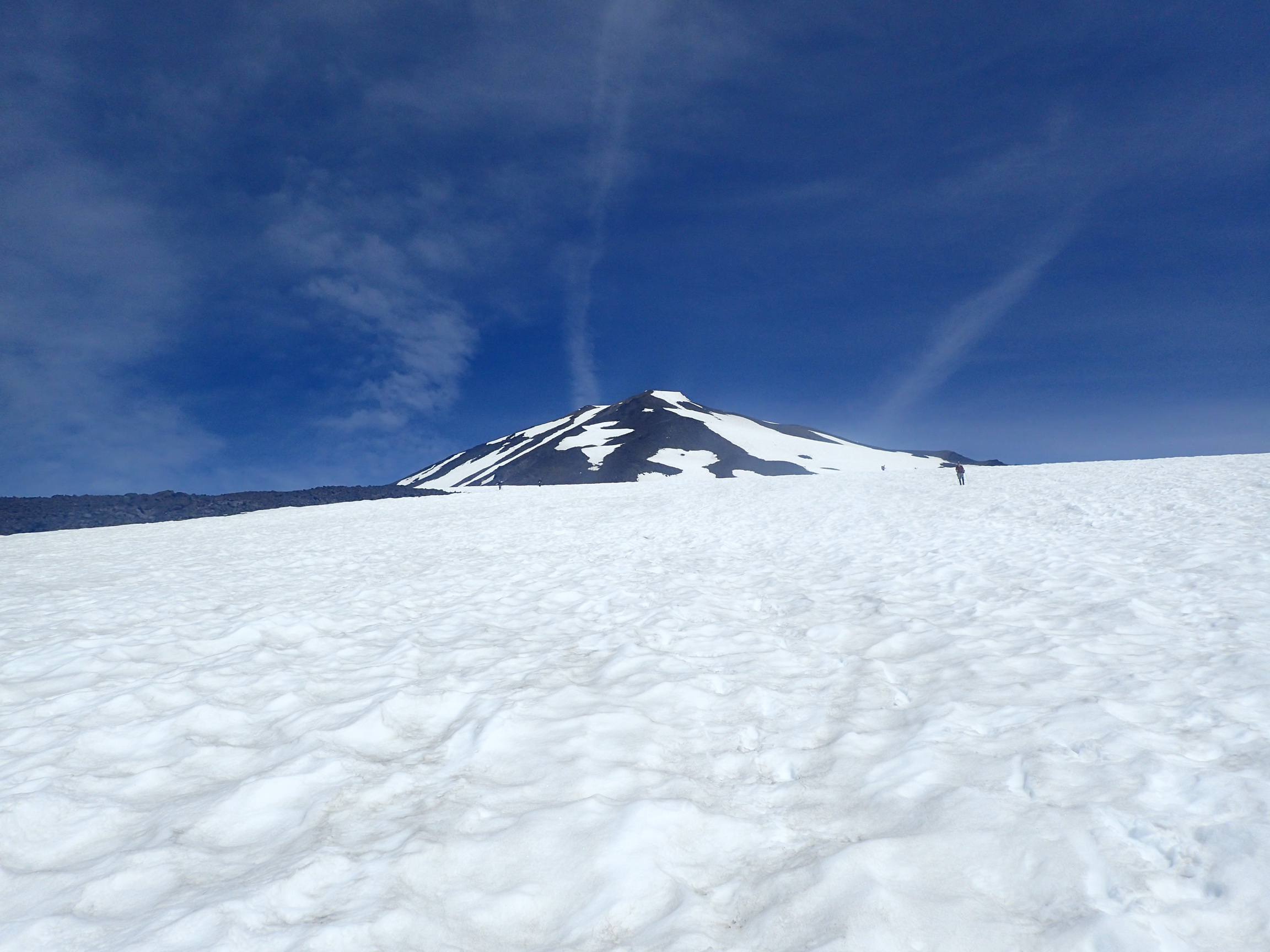
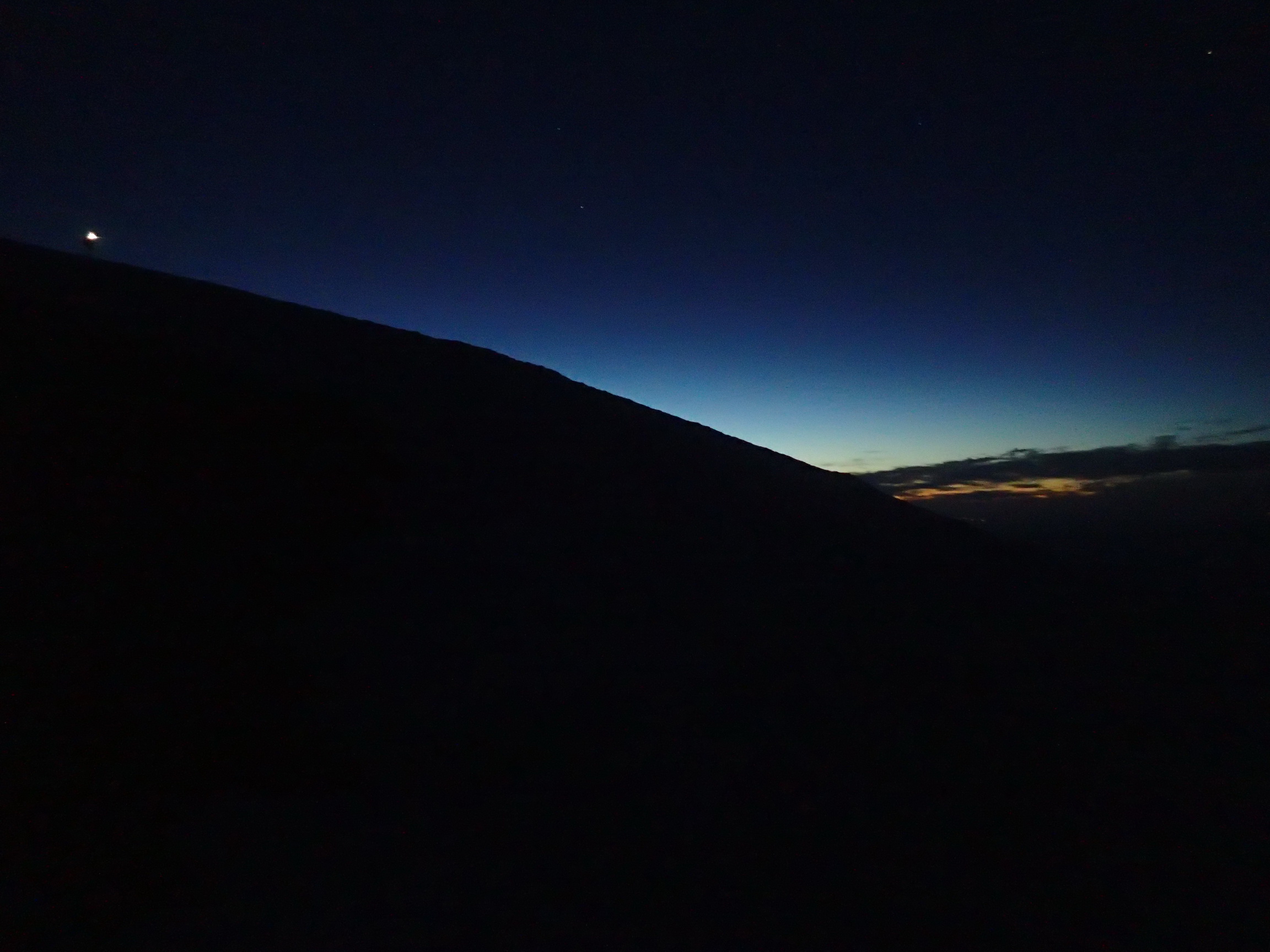
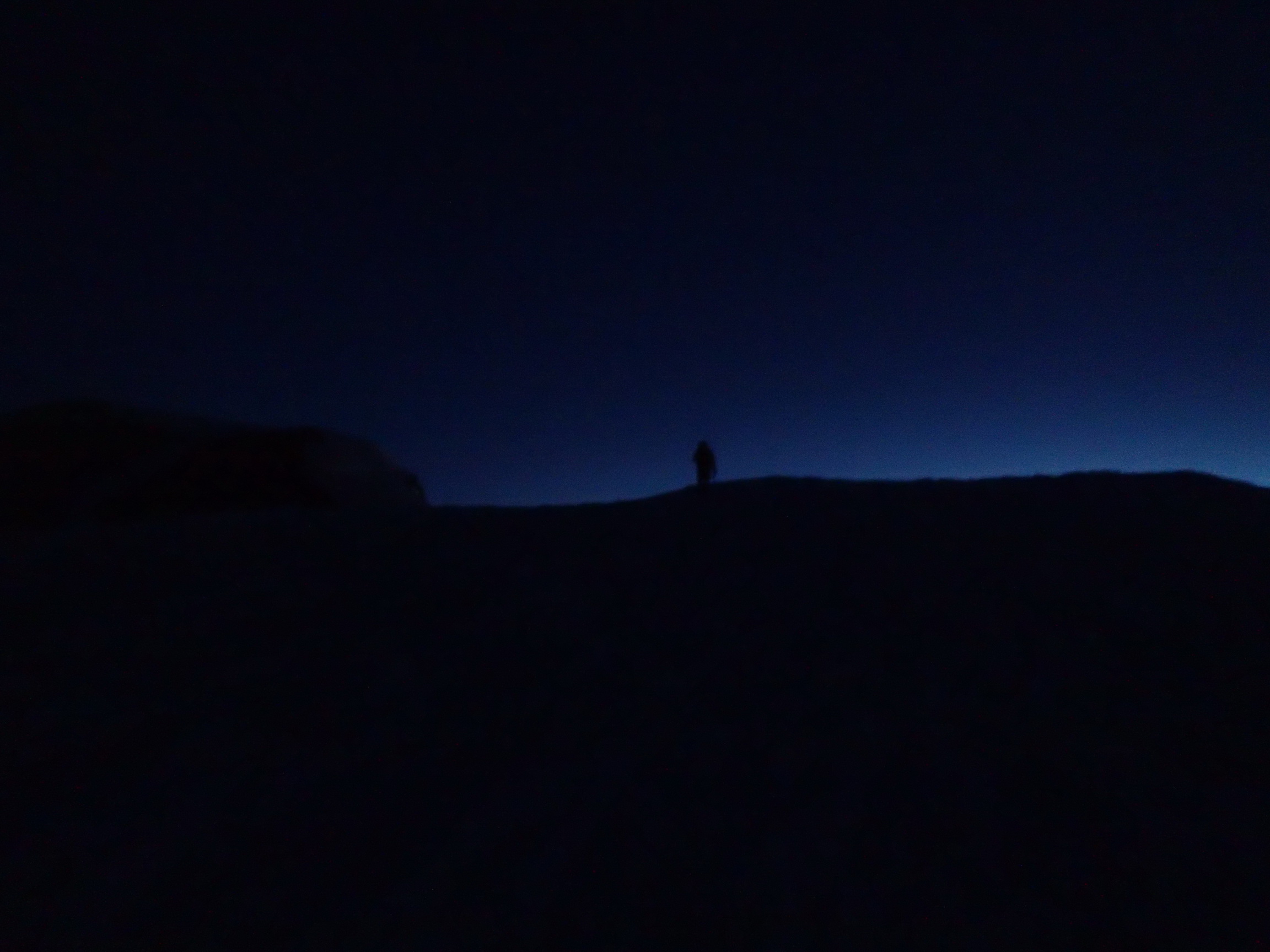
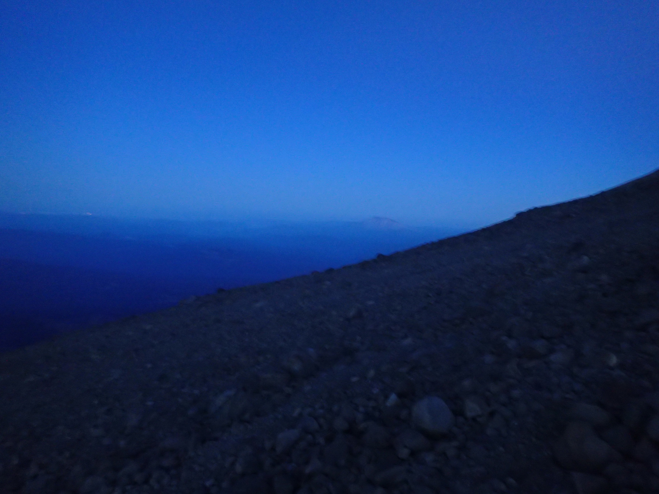
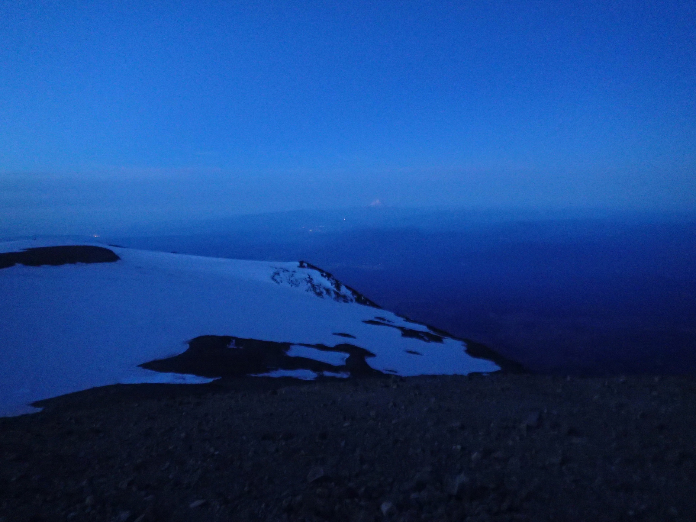
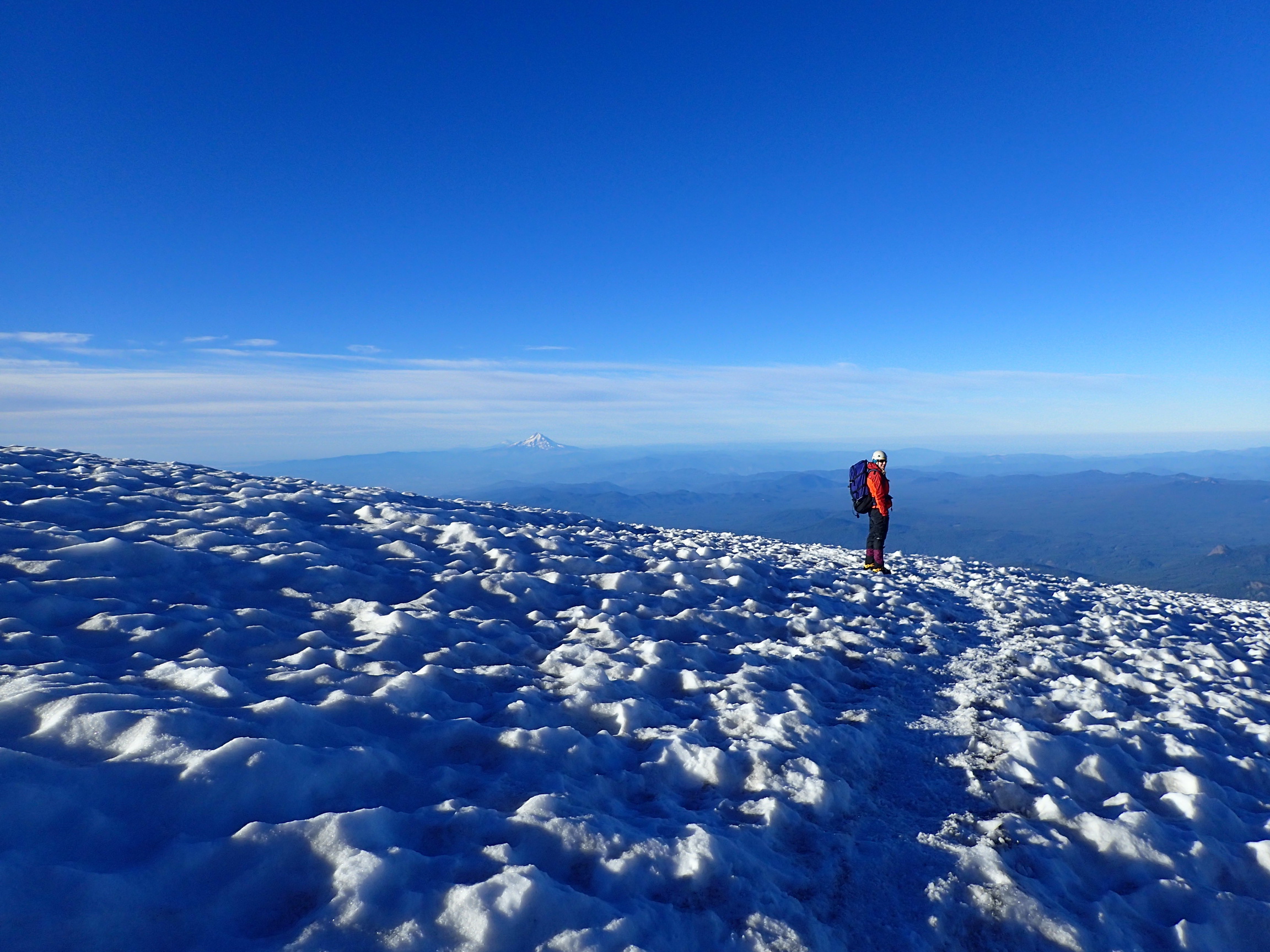
On Sunday morning at 2:30, we started hiking up from our camp site. We left the tent, sleeping bags, and all the other heavy things there, so our backpacks were a lot lighter. We knew we would get hot with the climbing we had to do, so we wore shorts with gaiters — fashionable! It took us a little under four hours to get from 9400 feet to 12280 feet. For the first hour, we hiked in the dark, because we wanted to see the sky and the shooting stars. When it got a bit steeper and the moon had settled behind the mountain, we turned our head lamps on and climbed with light. We got to the summit just at sunrise. It was an unbelievably beautiful moment.
We stayed on the summit for maybe 30 minutes. It was pretty cold, just barely above freezing, but not windy, fortunately. Then we descended. It took us longer than expected, because the snow was so hard that we couldn’t glissade down on it. We tried at one point, a little ways down from the top, where it was safe, but the snow was so hard, we got bruises on our butts. So we had to hike three hours down to camp. The last bit we were able to glissade again. There, we cooked some noodle soup, took a 20 minute nap, and then packed everything up.
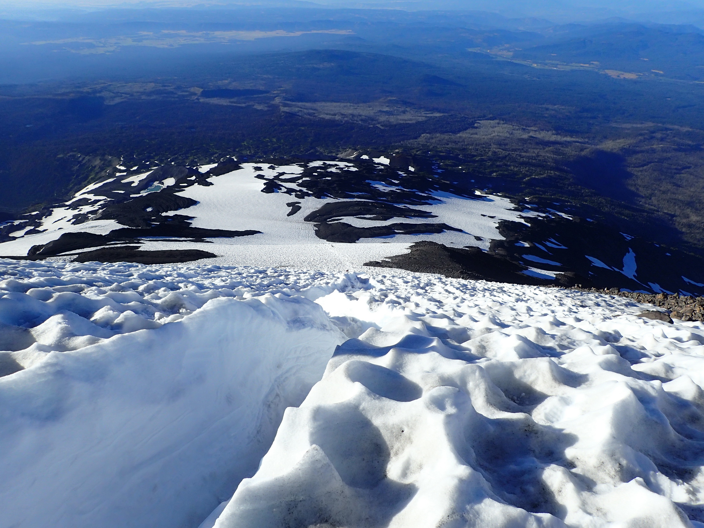
We hiked three more hours with full packs back to the car. Fortunately, we were able to avoid the rock ridge that we scrambled up by glissading down the last 1000 vertical feet of the Crescent Glacier. Note that the main, deep glissade chute was blocked with rocks. Generally, of course, it’s not safe to glissade if you can’t see or know the entire way. We glissaded down the slope a little to the west of the main chute.
It was a wonderful adventure, something I had wanted to do ever since I climbed Mount St. Helens for the first time in 2013.
On the trail from the Cold Creek trailhead.
Crossing Morrison Creek.
Above the Crescent Glacier.
At 9000 feet, just below the Lunch Counter.
Camp at 9400 feet.

Mount Hood and Mount Jefferson to the South.

Panorama of our view up the mountain from camp.
Just below Pikers Peak at first light.
Jenny on Pikers Peak.
On Pikers Peak, the false summit of Mount Adams.
Mount St. Helens to the west.
Sunrise near the summit.
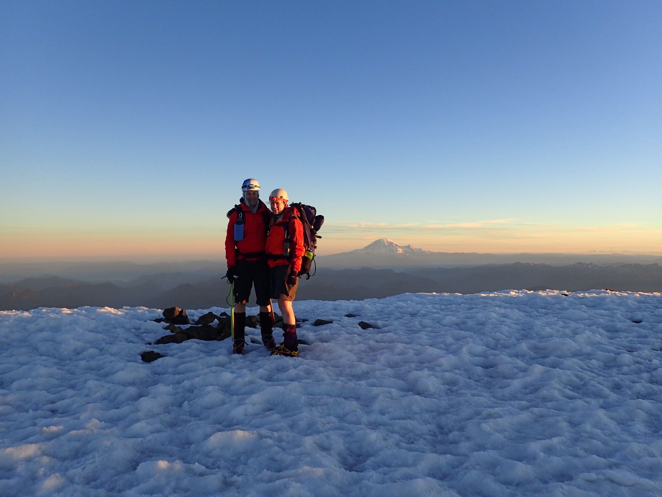
Successful summit of Mount Adams at 12280 feet. The only higher mountain in Washington is in the background.
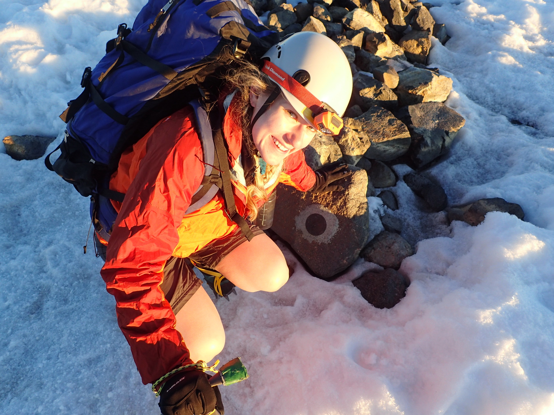
Jenny at the USGS summit marker.
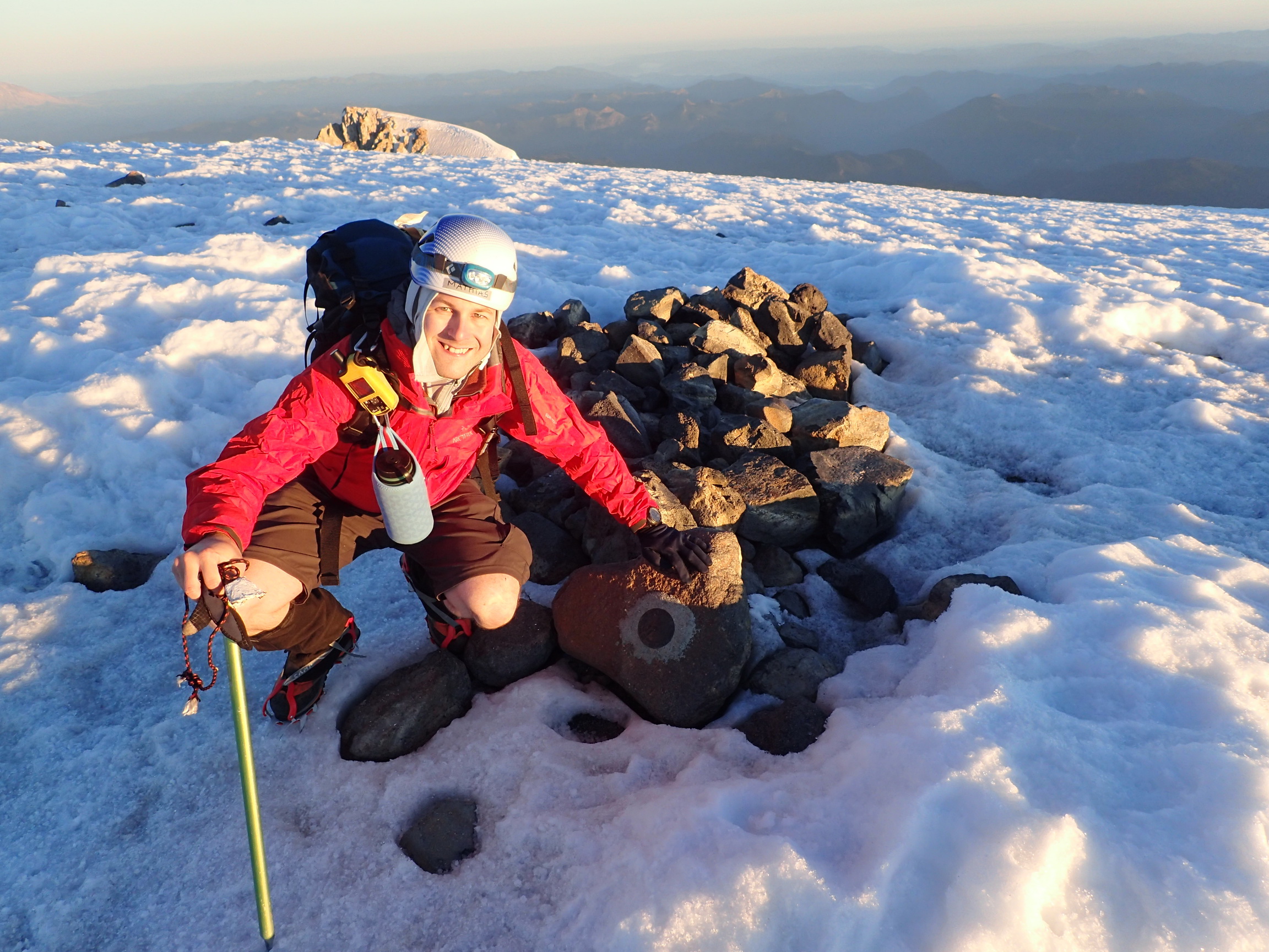
Mathias at 12280 feet.
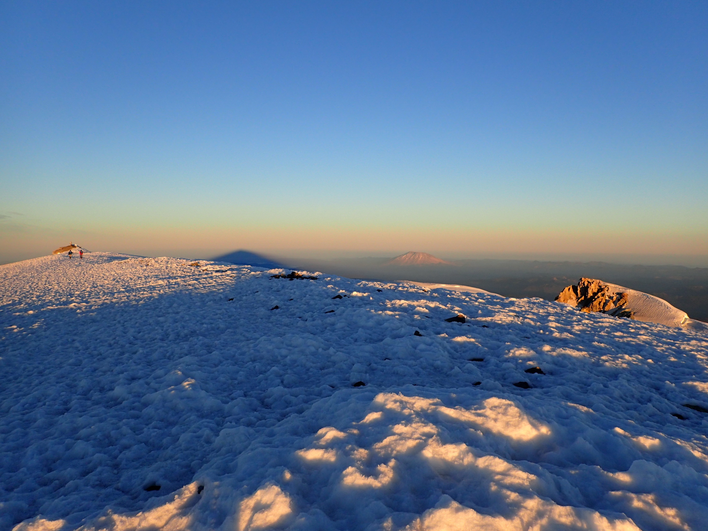
Mount St. Helens and Mount Adams’ own shadow on the ground.
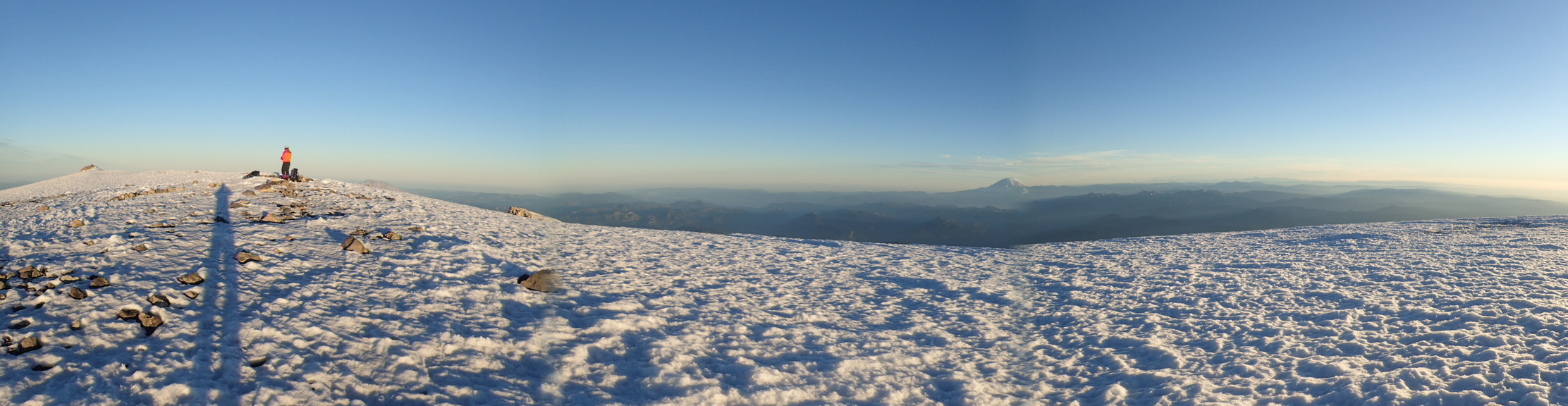
Summit panorama.
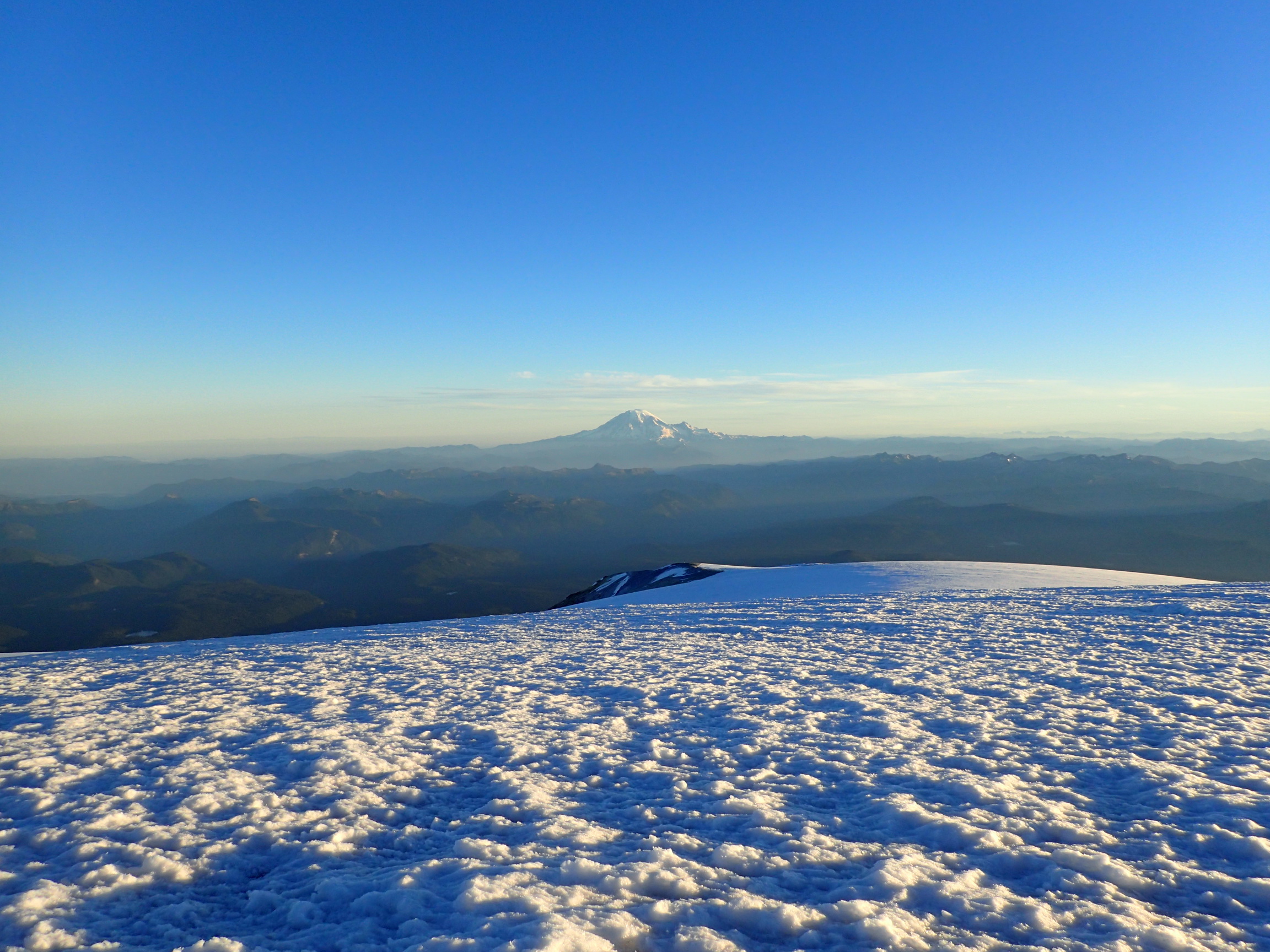
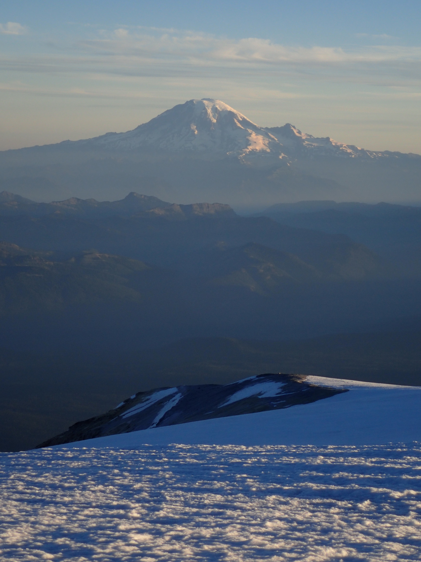
Mount Rainier, as seen from the summit of Mount Adams.
Tallest mountain in Washington, as seen from the second tallest mountain.
View back up to the true summit of Mount Adams.
On the way down to the ledge below Pikers Peak.
Sun above Pikers Peak.
Snow field down to camp.
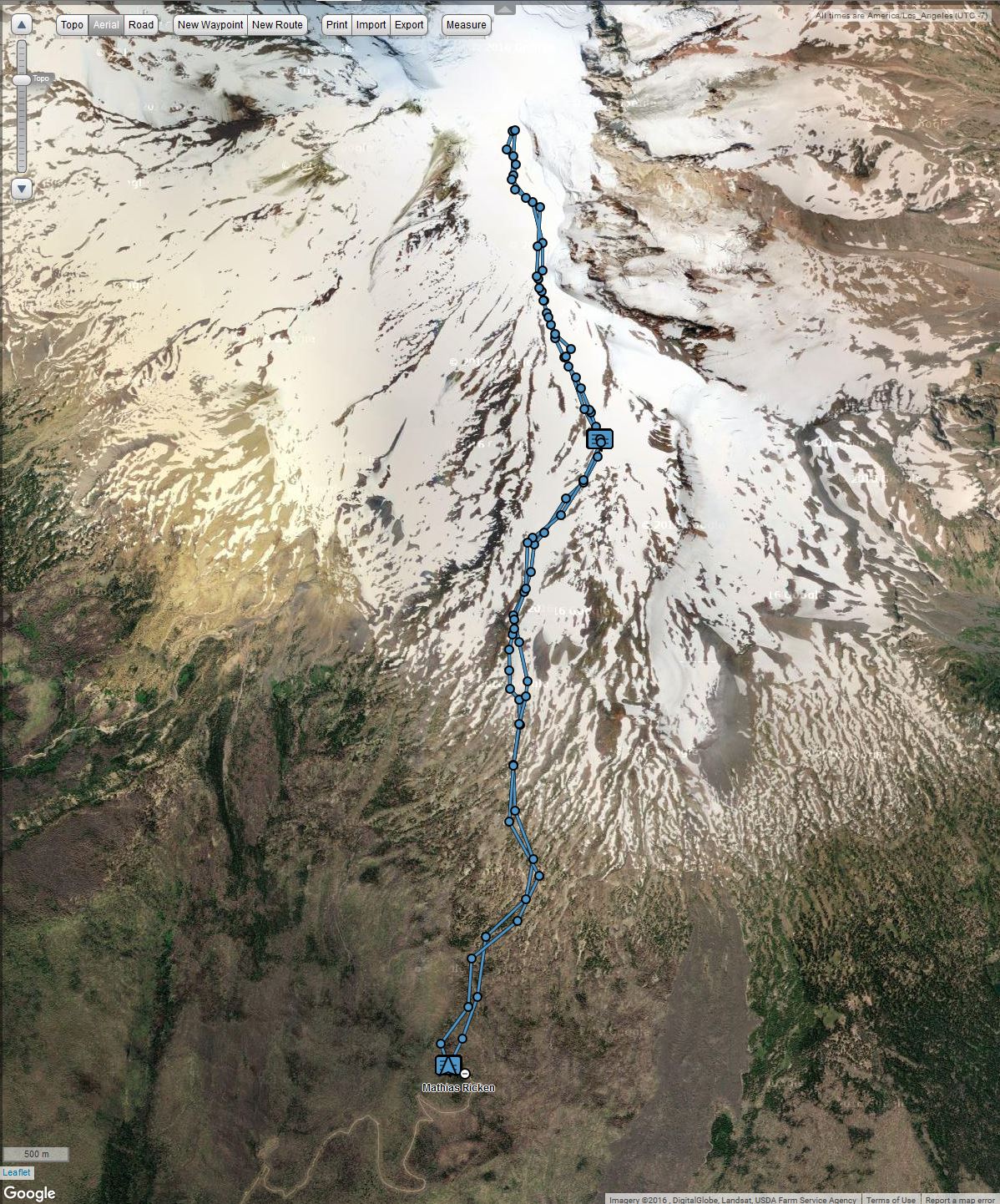
Route of the Mount Adams climb
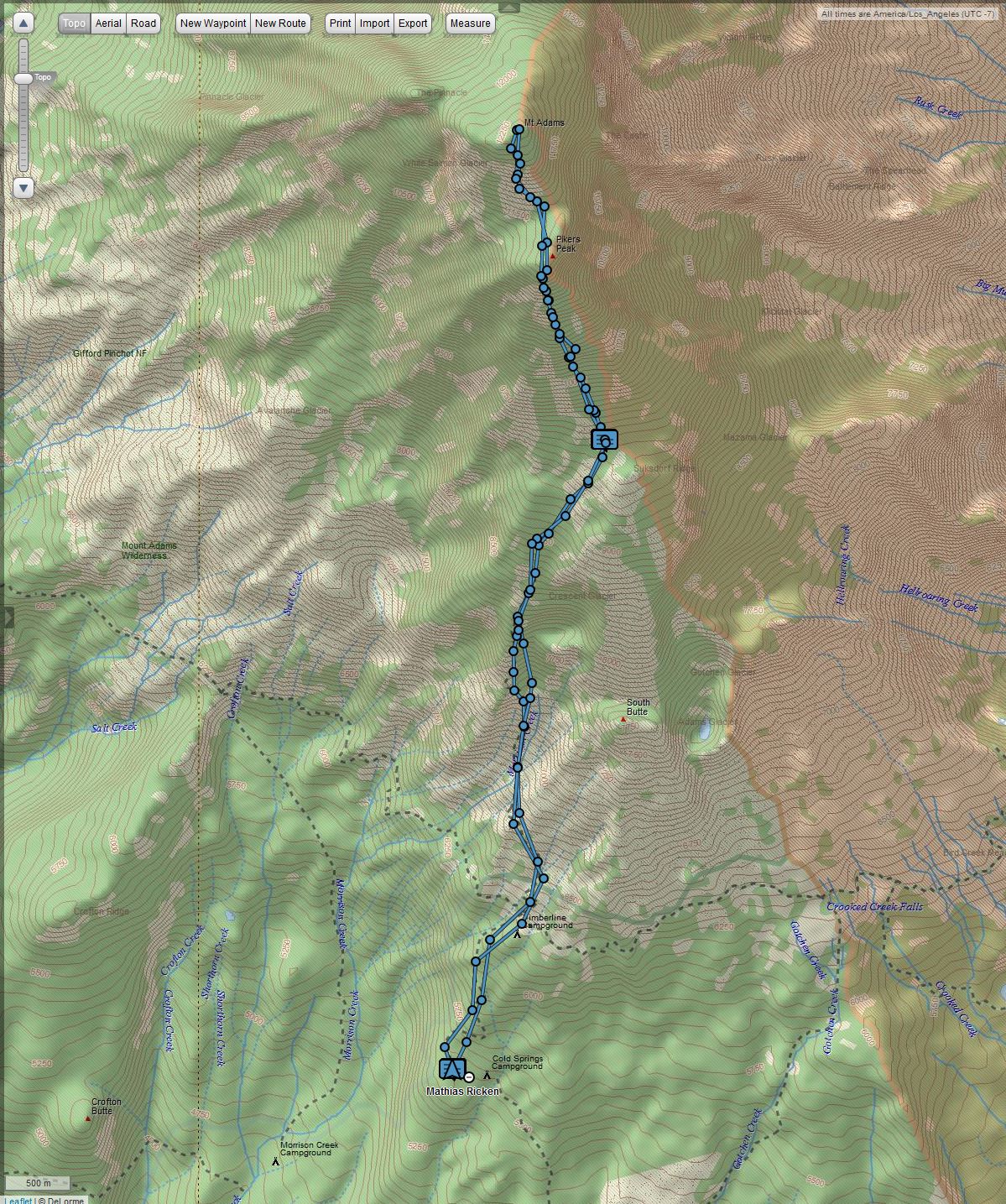
Route of the Mount Adams climb
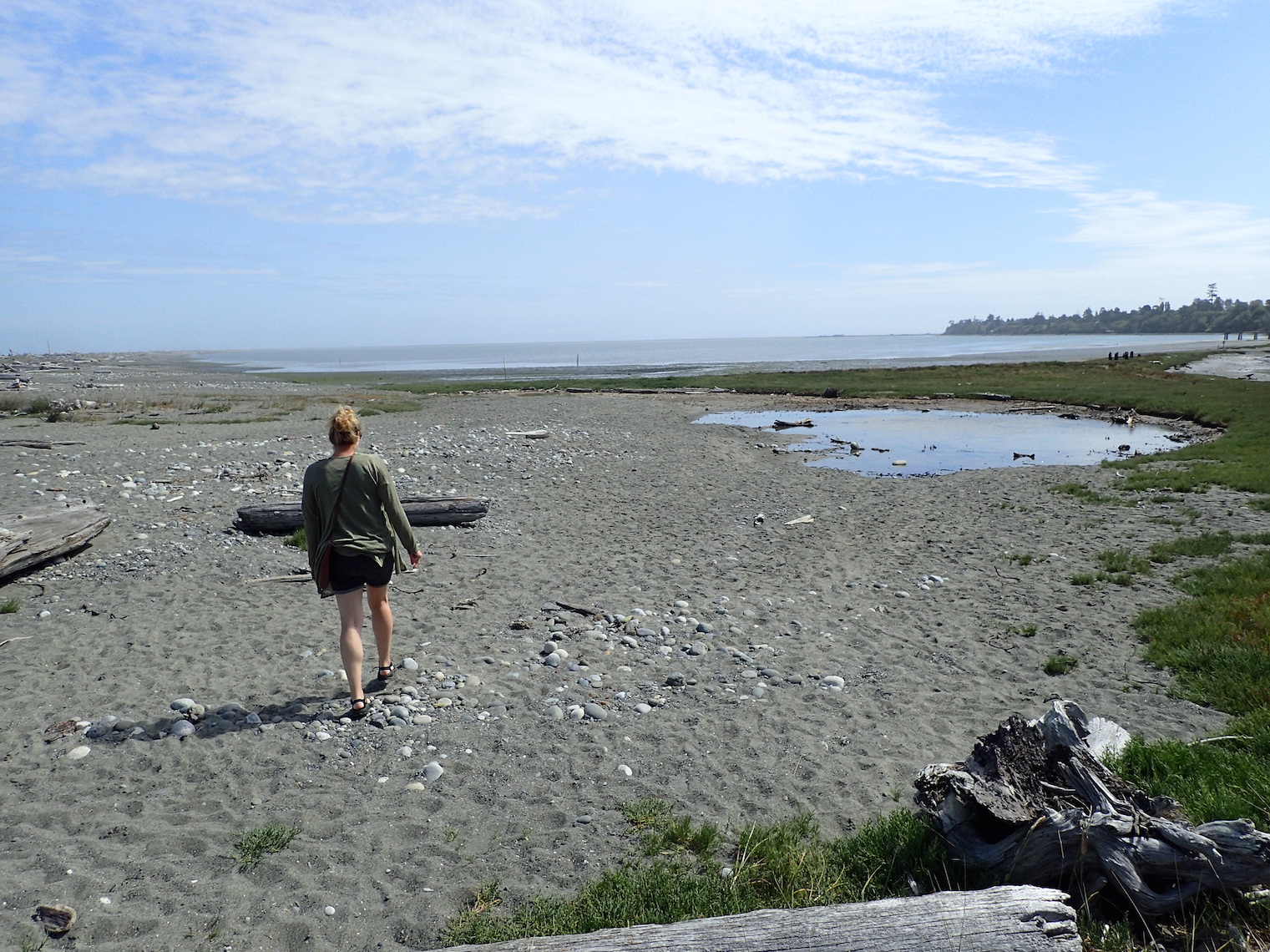
This past weekend, Jenny and I went on a trip to the northwest edge of the Olympic Peninsula.
We took the ferry from Seattle to Bremerton, had dinner on the bay, and stayed at a hotel. Early on Saturday, we had breakfast and started driving northwest. We stopped at the Dungeness National Wildlife Refuge, walked in the sand, and watched little crabs scurry sideways.
After coffee in Port Angeles, we drove out to Shi Shi. Google actually took us to someone’s backyard near Lake Ozette, though. So after that de-tour, we drove back around to the Strait of Juan de Fuca and through the Makah Indian Reservation to Shi Shi Beach.
Saturday night, we camped at Shi Shi Beach. Note that the self-issue permit box isn’t at the trailhead anymore. Instead, go to the NPS in Port Angeles. We camped only over night and never left our camp site unattended, but if you do that, you need an approved bear canister.
On the map, it had looked like Shi Shi Beach was outside the reservation, so we hadn’t purchased a recreation permit from the Makah. Since we were parking on the reservation, though, and then hiking about 2 miles to the coast, we had to get one. I dropped Jenny off with her pack and the tent and then drove away to buy the permit. The closest place that sold the permits turned out to be the Hobuck Beach Resort.
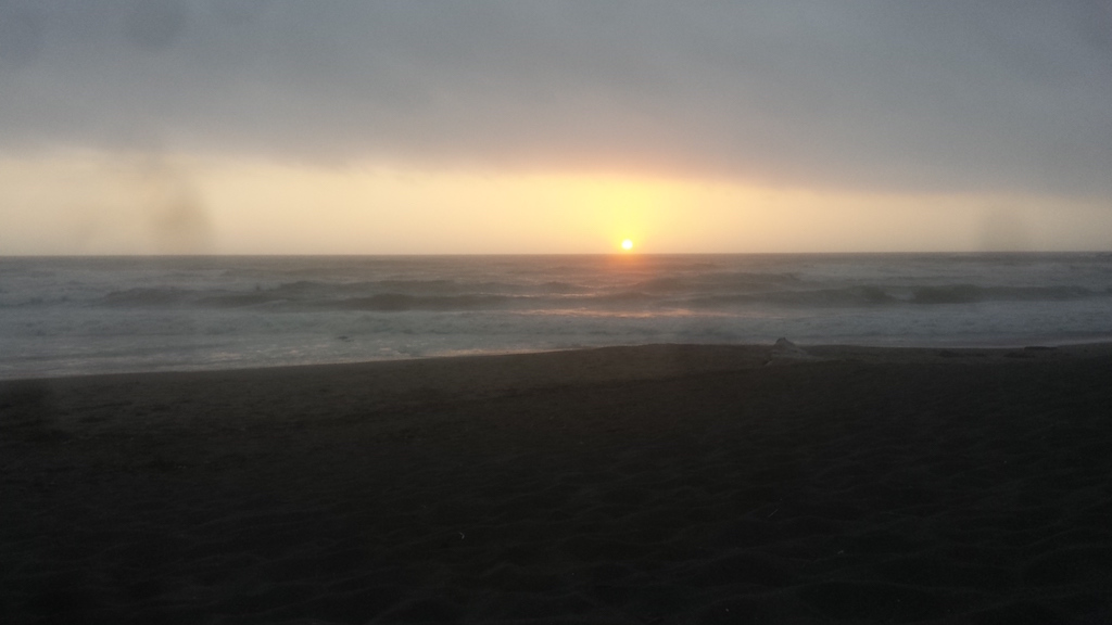
It took me about half an hour to get the permit and get back to the trailhead and grab my pack and gear, so shortly after I started hiking, Jenny already arrived at the beach and started setting up the tent. She got it done in 10 minutes and was starting to settle down in the sunny sand just as I arrived. We enjoyed the sunset with champagne from Nalgene bottles.
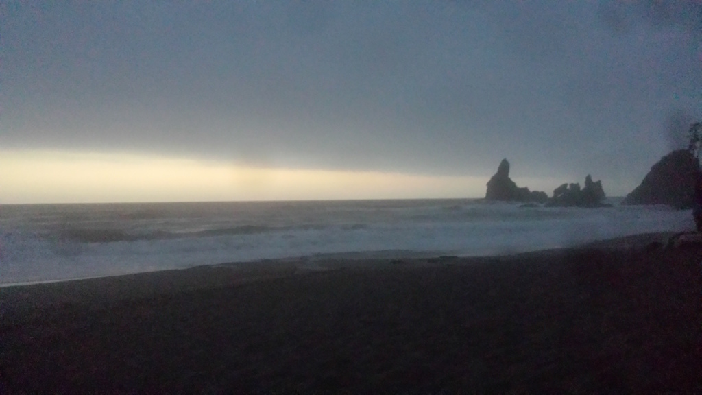
On Sunday, we went to Cape Flattery (it’s a great cape!), had brunch at Port Angeles, and then enjoyed a free jazz concert in Kingston as we waited for our ferry back.
Leaving beautiful, sunny Seattle.
Dungeness Bay
Dungeness Bay
Shi Shi Beach sunset
Shi Shi Beach

Cape Flattery

Cape Flattery
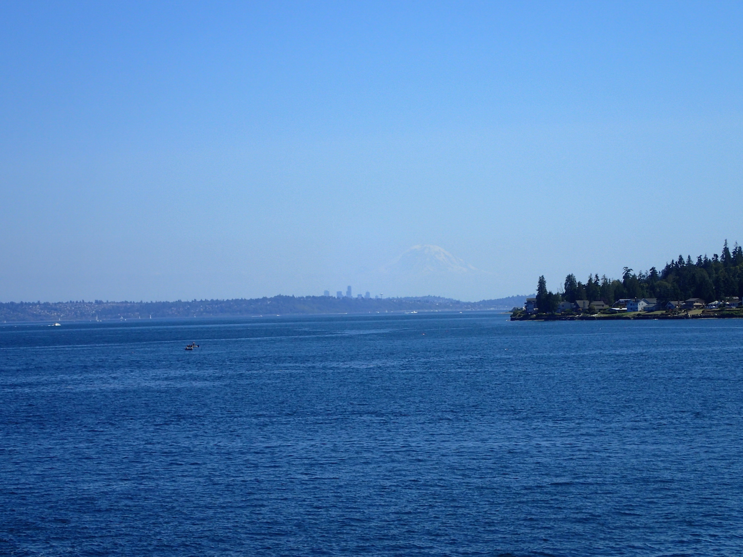
On the ferry to Edmonds. Mount Rainier dwarves Seattle.
Here’s the video I recorded on the summit of Eldorado Peak. Our knowledgeable climb leaders are pointing out many of the peaks that were visible: Mount Baker, Shuksan, Glacier Peak, Rainier, Forbidden Peak, and many, many more.
Here are a few more pictures from our Eldorado Peak climb. These were taken by fellow climber Phil.
On the ridge towards the Inspiration Glacier, shortly after breaking camp.
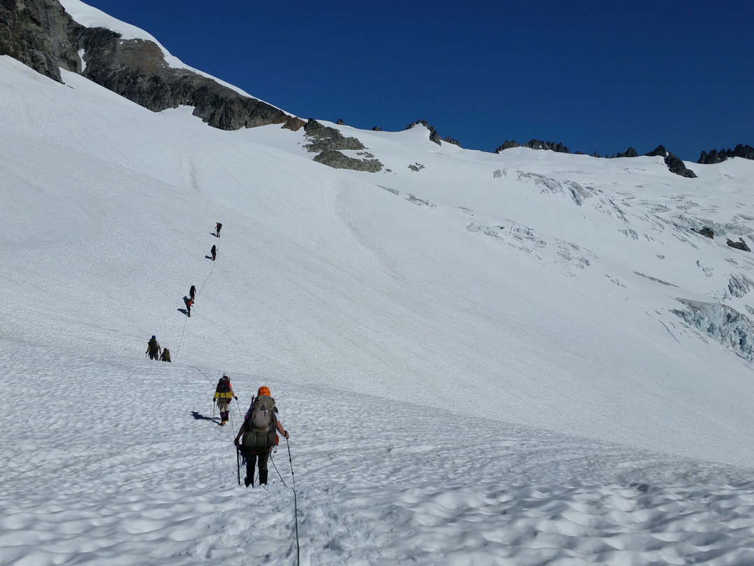
On the Inspiration Glacier. I’m in the middle of the first rope team.
Heading up the Inspiration Glacier, with some of the few crevasses visible.
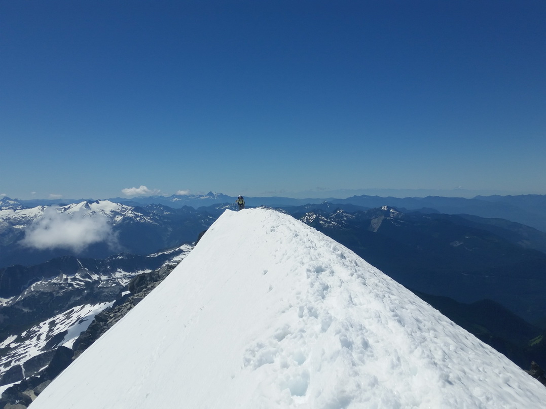
On the Knife Edge at the summit of Eldorado Peak.
Coiling our glacier rope on the summit of Eldorado Peak.

Descending toward the Inspiration Glacier.
Still above the Inspiration Glacier. Instead of roping up and crossing the glacier near the big crevasses, we descended a short portion across rock instead.
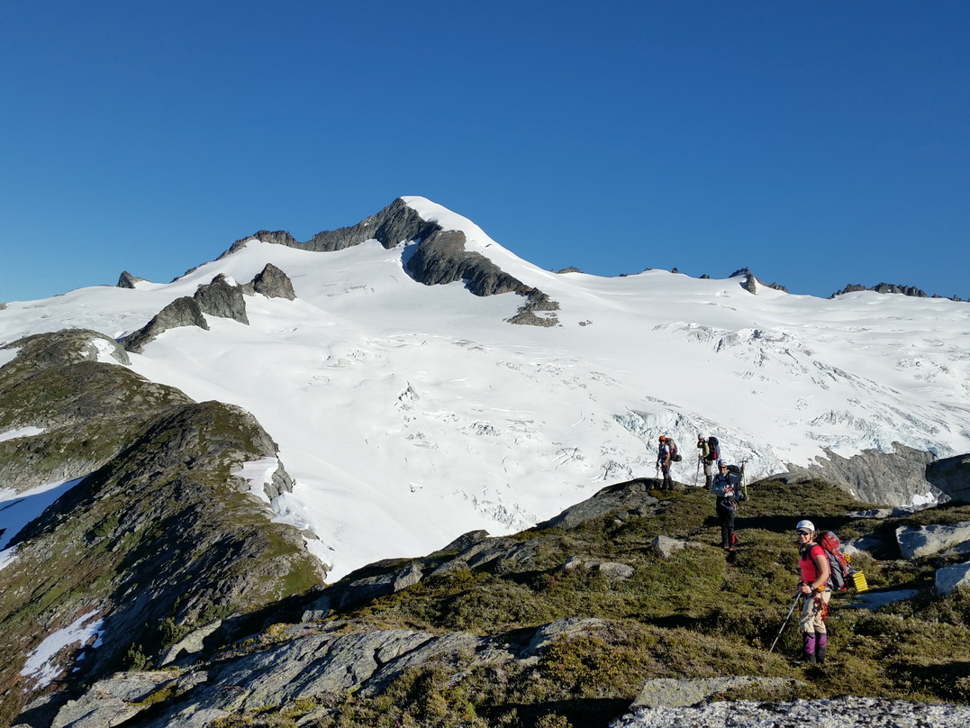
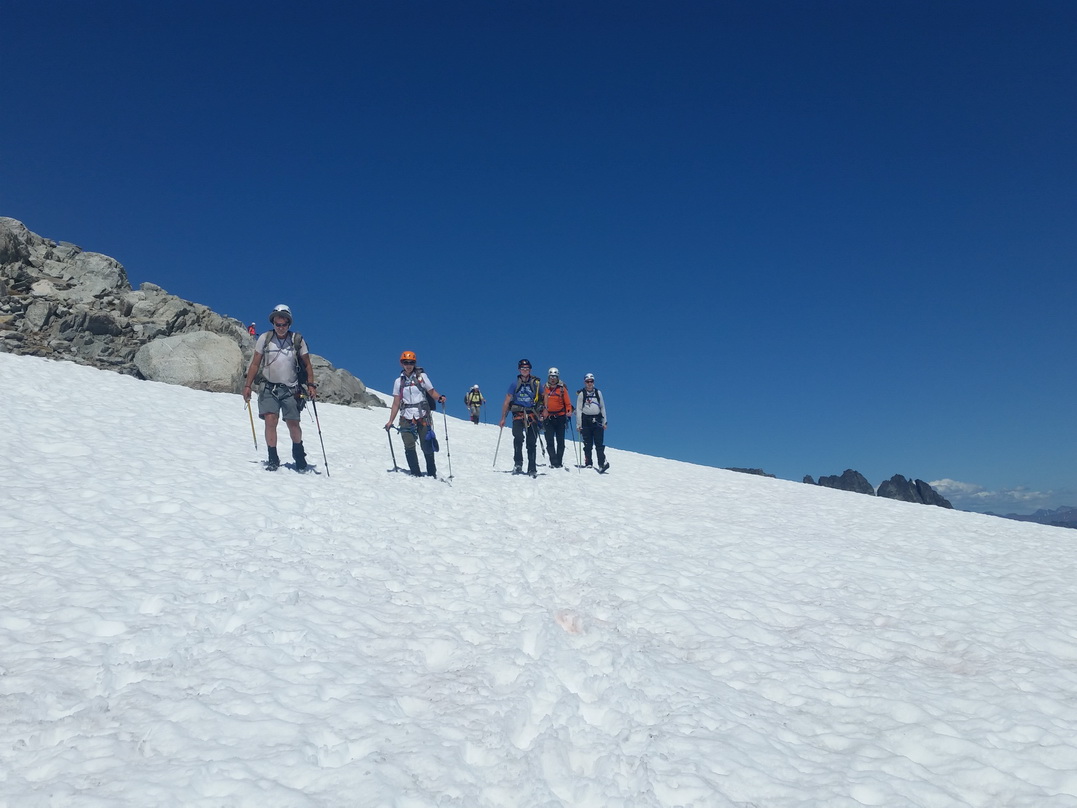
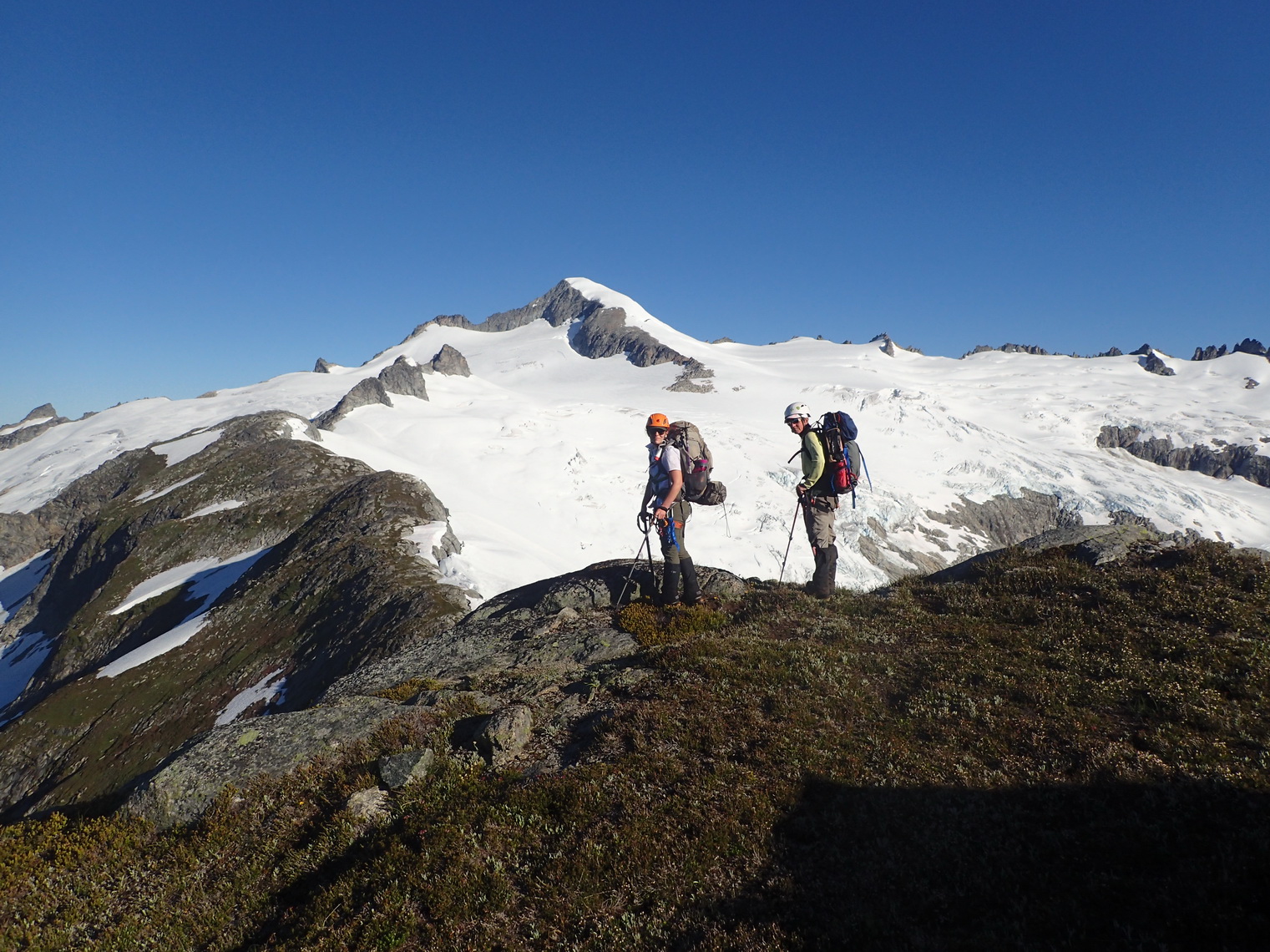
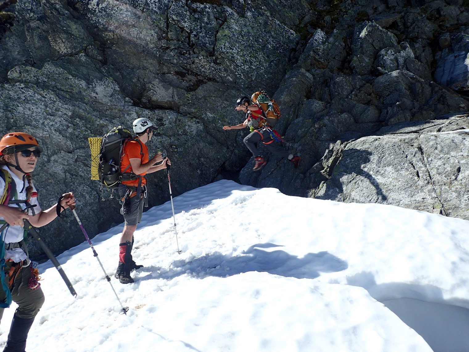
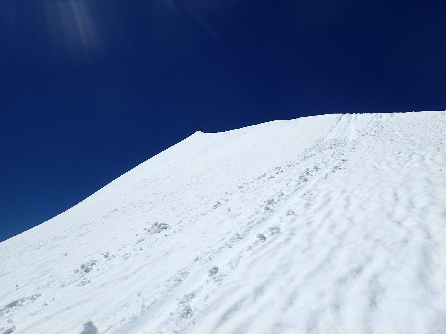
The last climb I needed to graduate from the Mountaineers Basic Alpine Climbing Course was a glacier climb, and after many cancellations due to bad weather, I finally got the chance this past weekend.
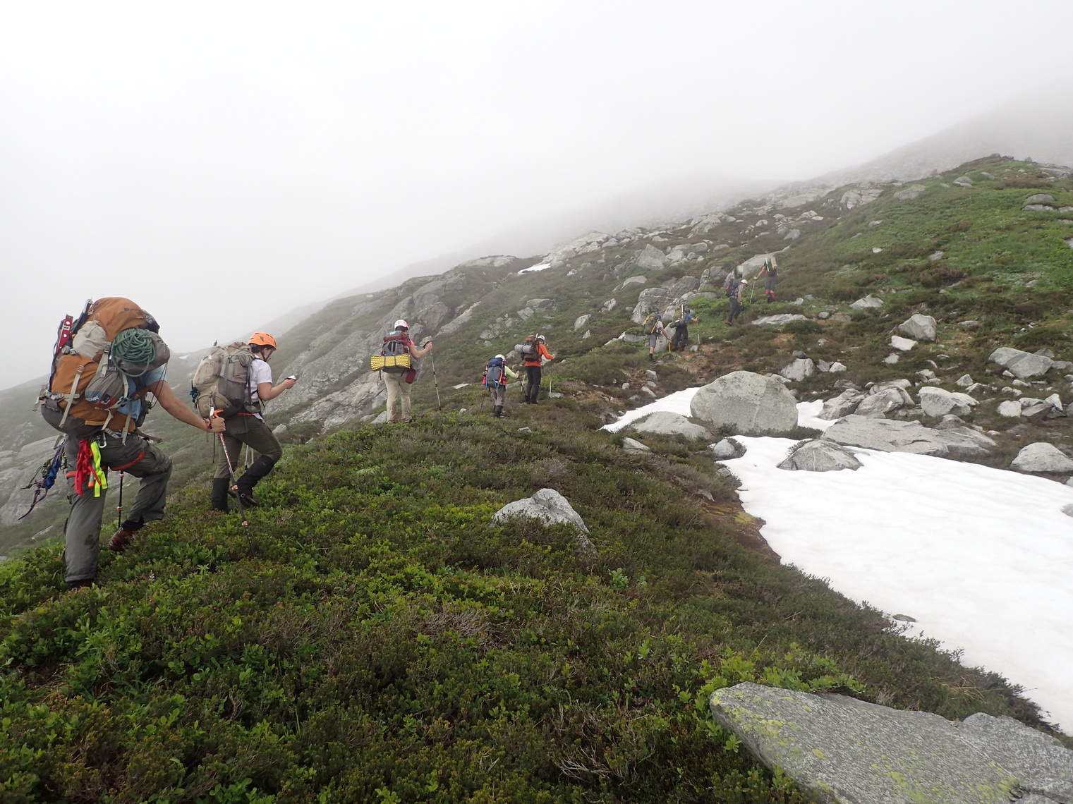
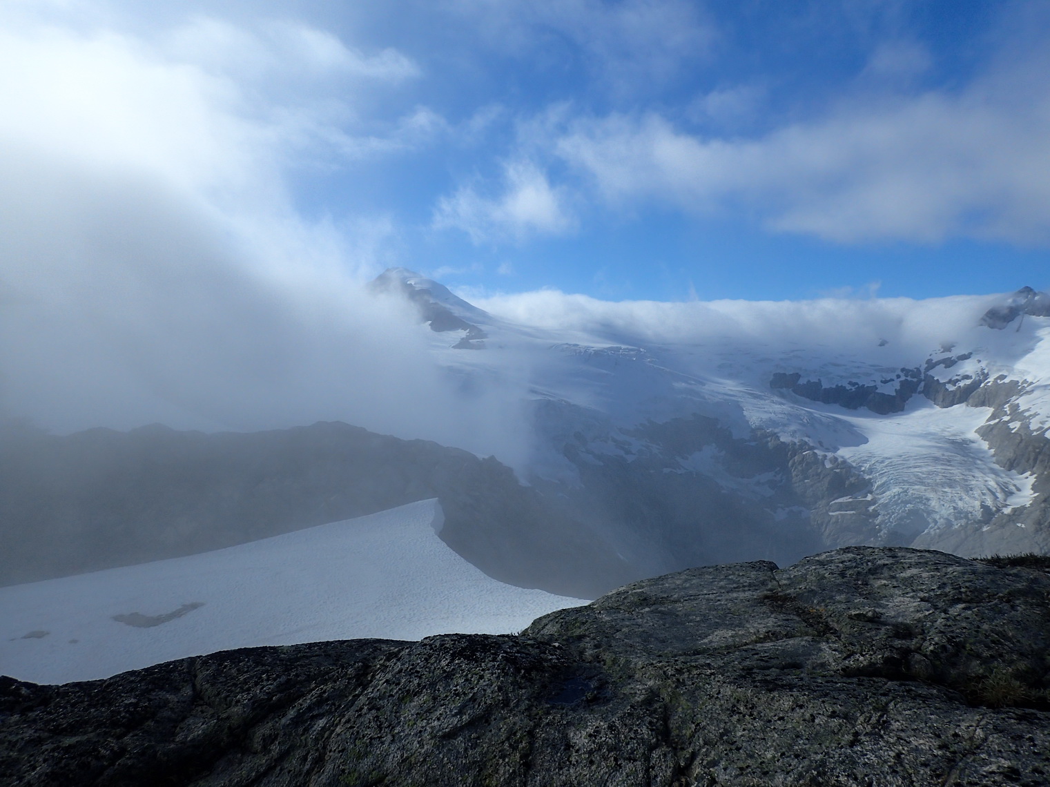
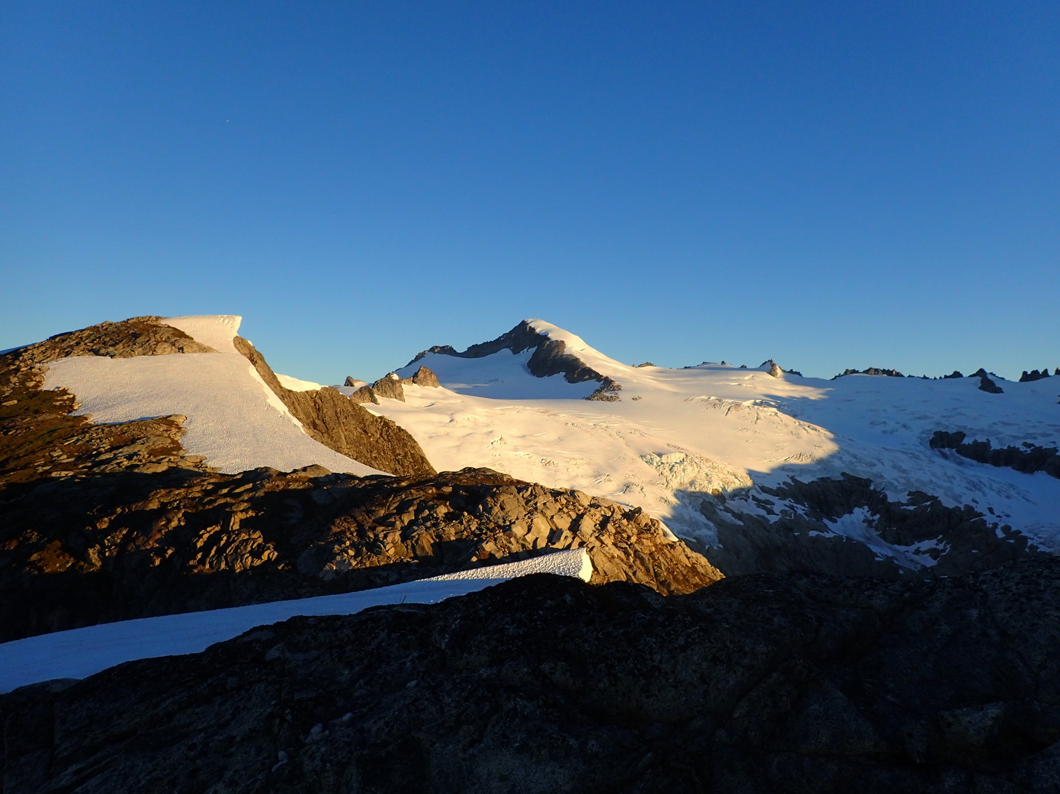
We headed up Torment Creek, then followed the ridge line above Moraine Lake to the west. Early in the afternoon, we camped near Point 7252, surrounded by clouds. The visibility on Saturday was only a few hundred feet, and that was definitely a bit of a downer. We were surrounded by amazing mountain beauty, we just couldn’t see it.
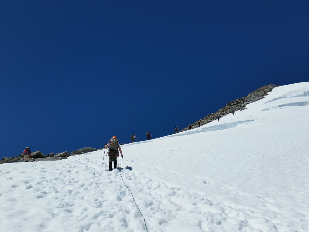
In the morning, we headed out at 7 AM and followed the ridge west. We jumped across a moat onto the Inspiration Glacier near Point 7292. There were only very few crevasses. Some of us summited the Eggplant (Point 7733), but I decided to rest my legs. I had felt a twinge in my right thigh since the morning, and I wanted to make sure I make it to the summit of Eldorado Peak. We dropped some gear and joined the standard ascent route. About an hour later, we summited Eldorado Peak at 1 PM. I was standing on top of Washington’s 25th tallest mountain. The Knife Edge leading up to it fortunately was not very edgy. We then took the standard route down Eldorado Creek back to the trailhead. I was at home past midnight, tired and dirty, but very happy.
Now I’m a Mountaineers basic climbing graduate. Out of 160 students this year, I was the 10th to finish. Jenny was 9th, but only because we didn’t fill out her application form for ten days, otherwise she might have been 3rd or so.
Below Mount Torment, heading towards the ridge above Moraine Lake.
First glimpse of Eldorado Peak from our camp site.

At our camp site near Point 7252.
Eldorado Peak in full morning glory.
Left camp at 7 AM to head towards the Inspiration Glacier.

Following the ridge above Moraine Lake.
Jumping onto the Inspiration Glacier near Point 7292.

On the Inspiration Glacier, with Eldorado Peak in the background.
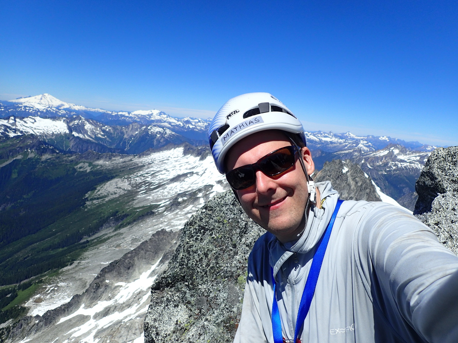
Happy on the summit of Eldorado Peak, the 25th highest mountain in Washington.
Looking back up at the Knife Edge.

Descending below the Knife Edge.
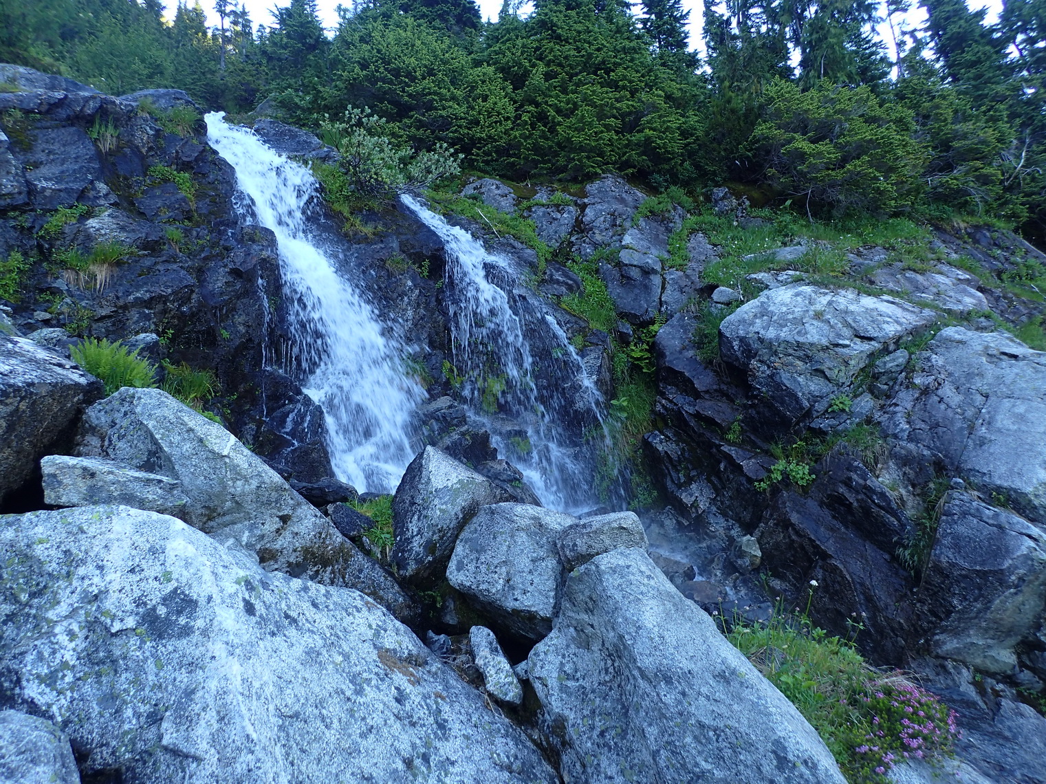
Streams and waterfall galore on the standard descent along Eldorado Creek.
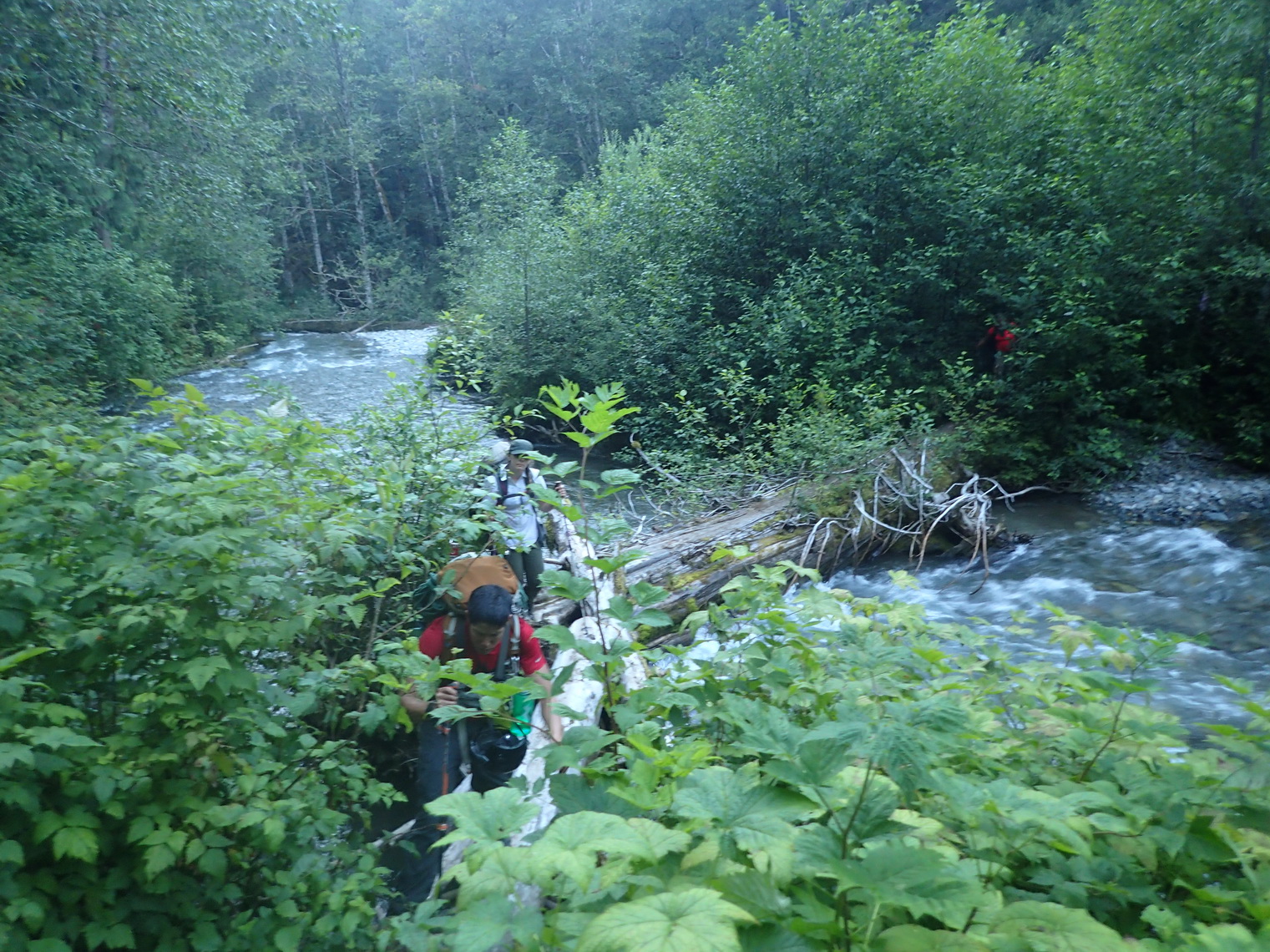
Log crossing over the North Fork Cascade River.
Unfortunately, I forgot to turn on tracking on the second day, so only my messages are marked in important spots — like the summit!
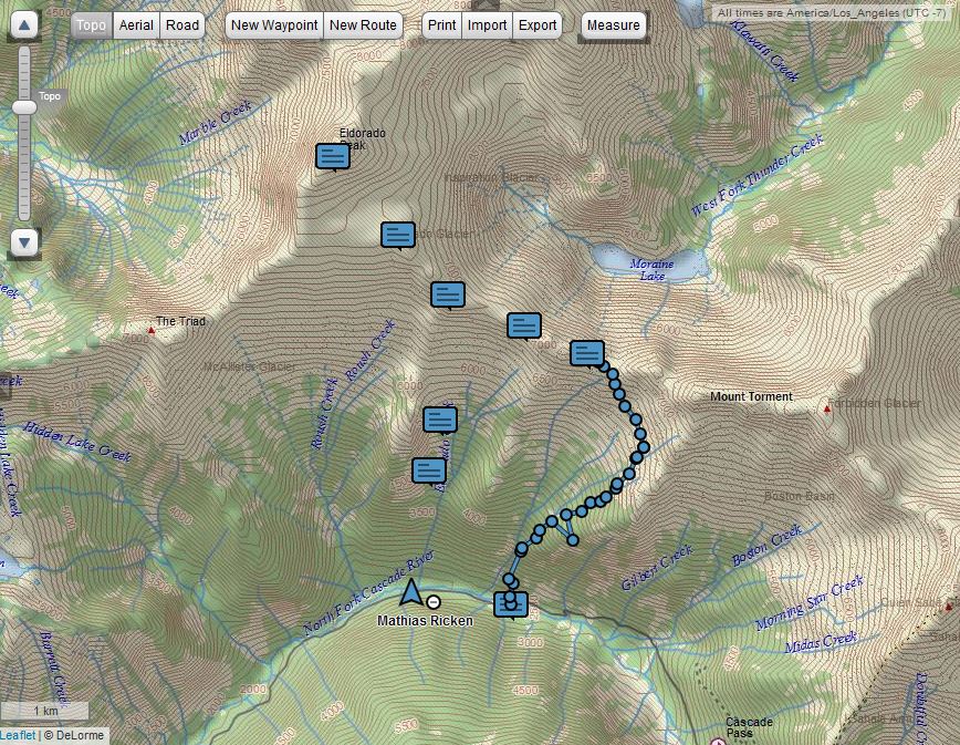
Track to Eldorado Peak.
For the last five years or so I’ve been using a Dell Zino HD as my media center PC. It’s worked pretty well, but lately, the computer sometimes “forgets” that it has an HDMI port. The TV just goes blank, and there’s nothing I can do anymore. I found out that the computer still works, it’s just displaying on the VGA output instead.
My solution in the past had been to hook up a VGA monitor, use that to click on “detect displays”, which usually makes the Zino remember its HDMI port again.
Now that I’ve moved, though, there’s no good place to hide the VGA monitor anymore, and I don’t want to have it just sit on the floor, below the TV. And I actually can’t use the VGA connection. Well, I could, but if I do that, then my TV isn’t connected to the computer using HDMI, and then Windows won’t detect the HDMI port either. So I thought maybe I can solve the problem with a remote desktop connection.
Unfortunately, when I use Remote Desktop, detecting displays isn’t allowed. But I’ve found that using a remote desktop connection to open the Device Manager, looking at the Monitors, and clicking “scan for hardware changes” is usually enough.
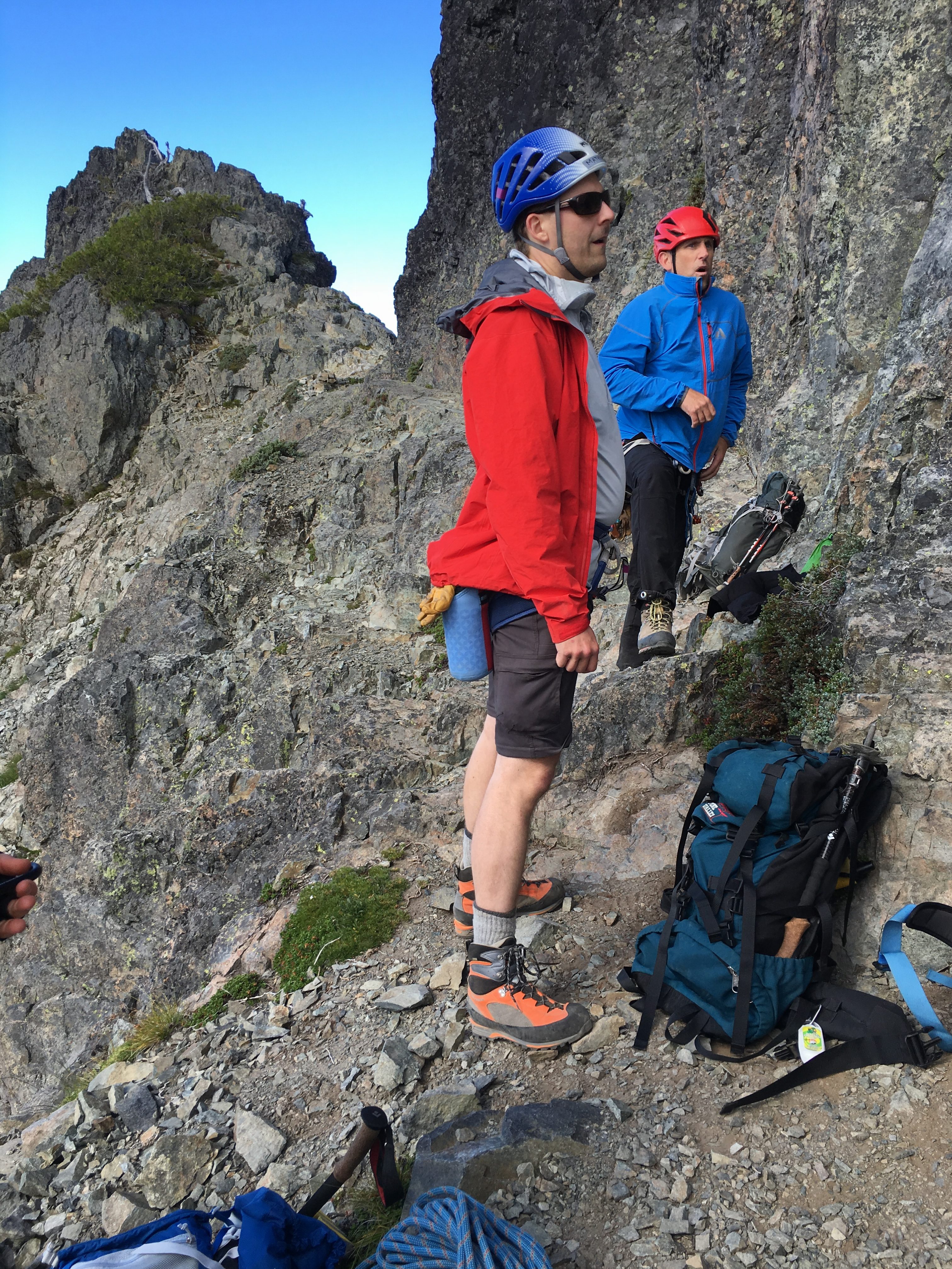
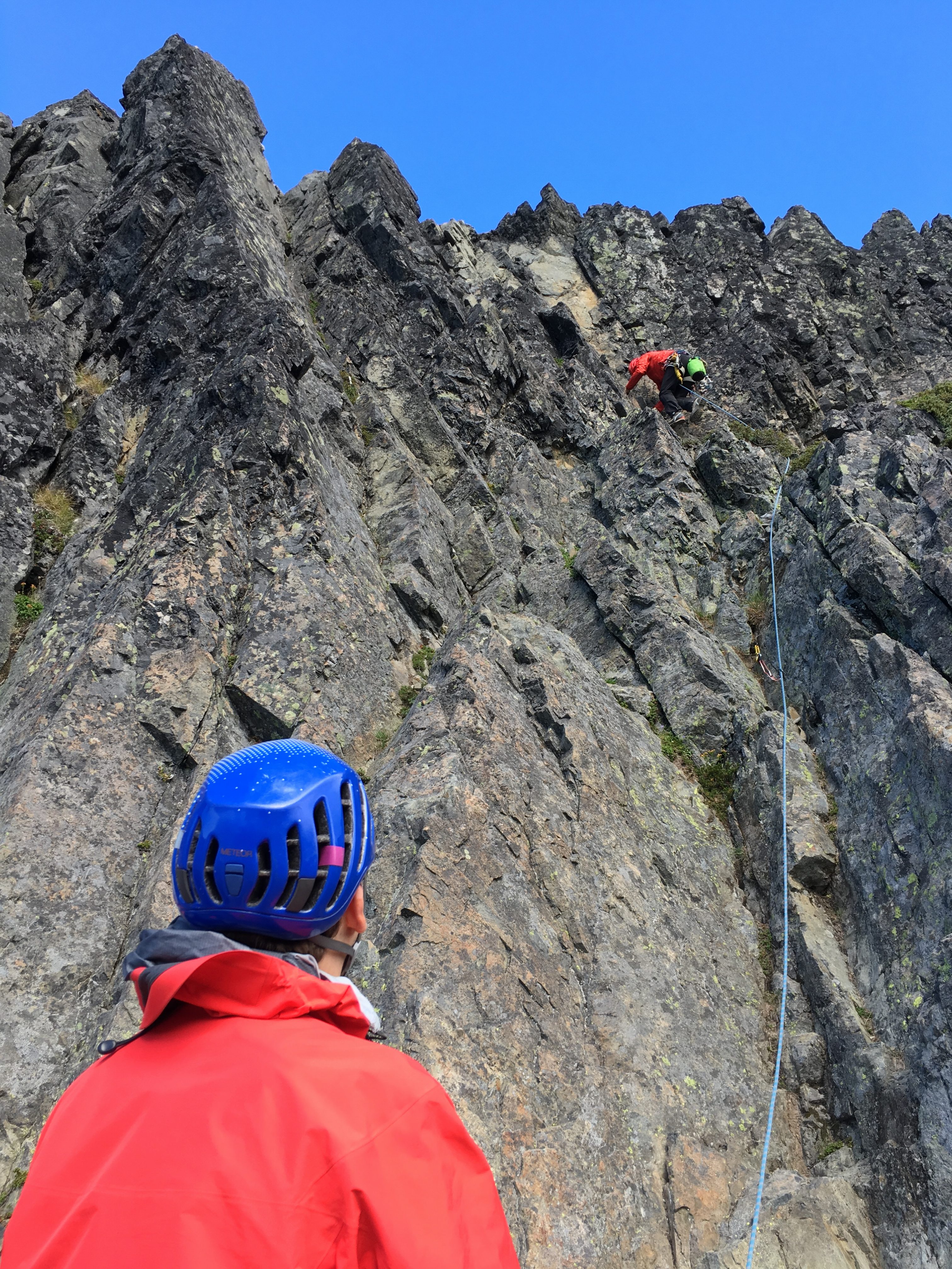
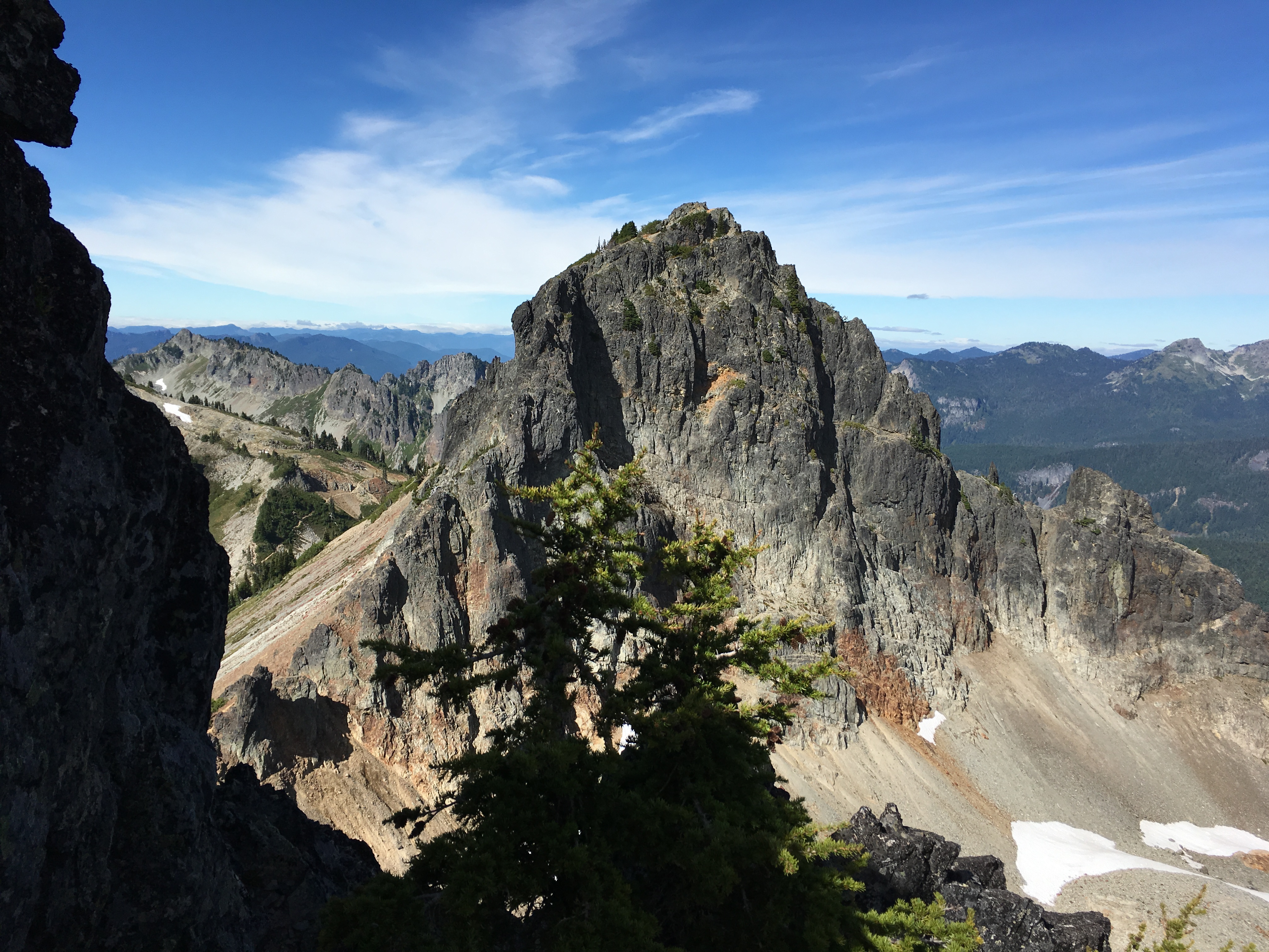
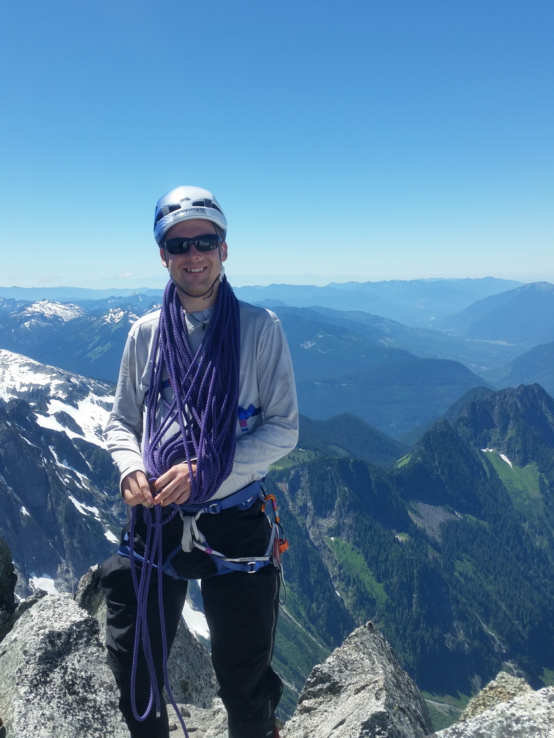
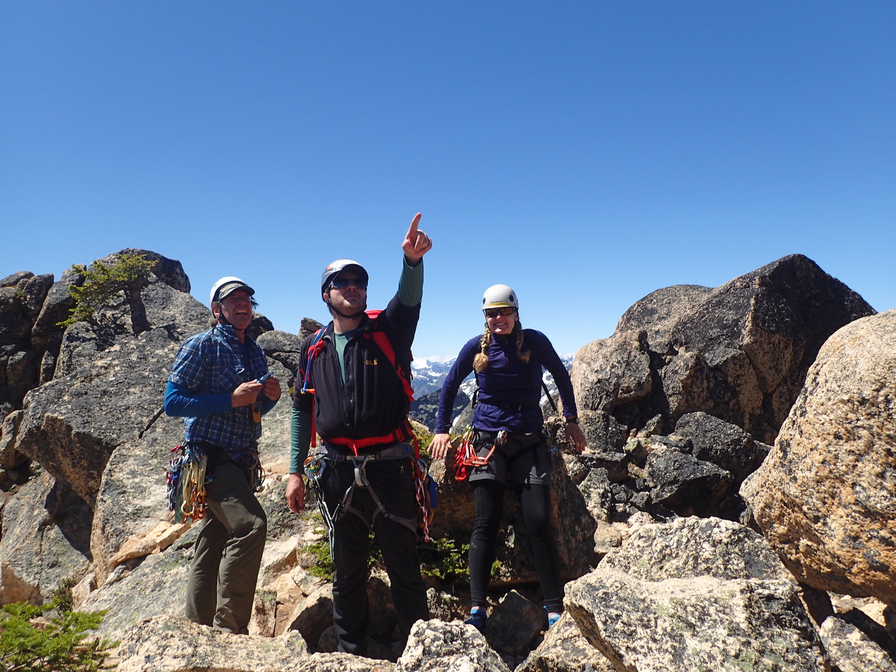
Yesterday, Jenny and I climbed South Early Winters Spire with the Mountaineers. For Jenny, it was her graduation climb: She has officially finished all the requirements for the Basic Alpine Climbing course. I still need a successful glacier climb (but I’ve had two more successful rock climbs now than required).
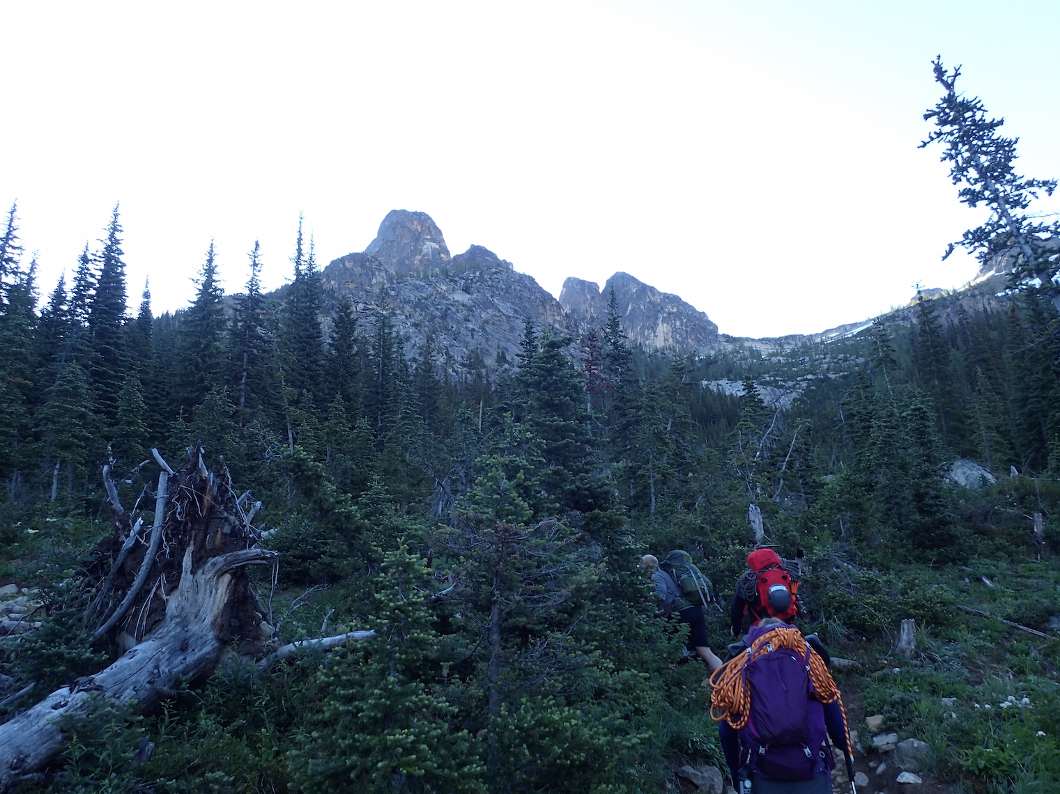
On the way to South Early Winters Spire. From left to right, Liberty Bell, North Early Winters Spire, South Early Winters Spire.
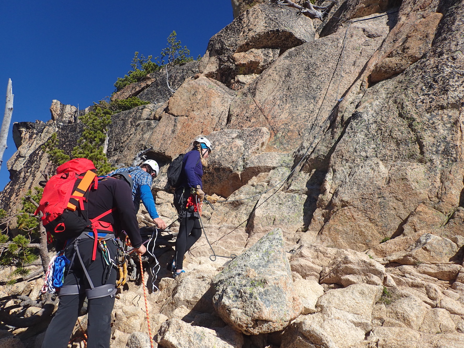
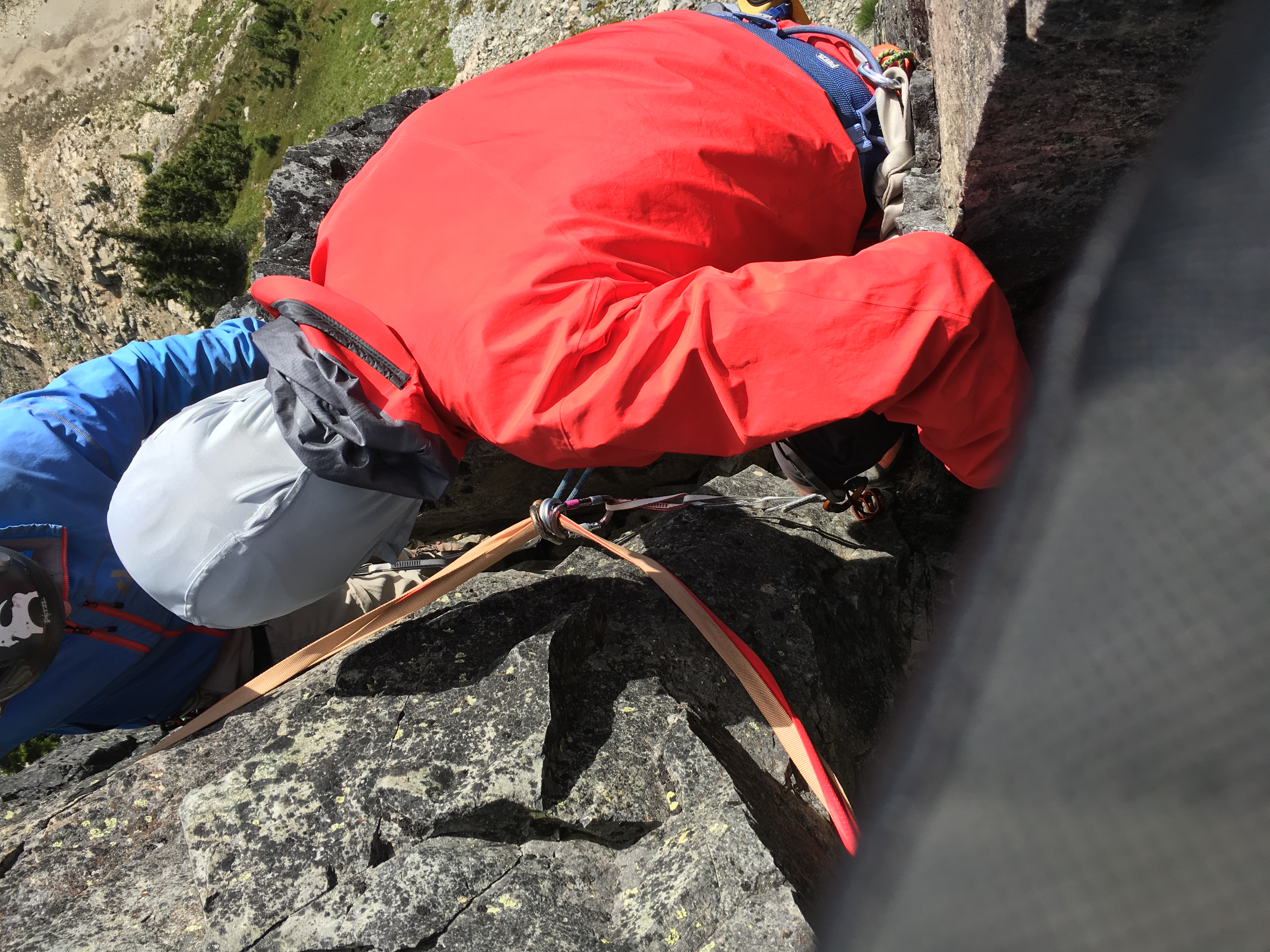
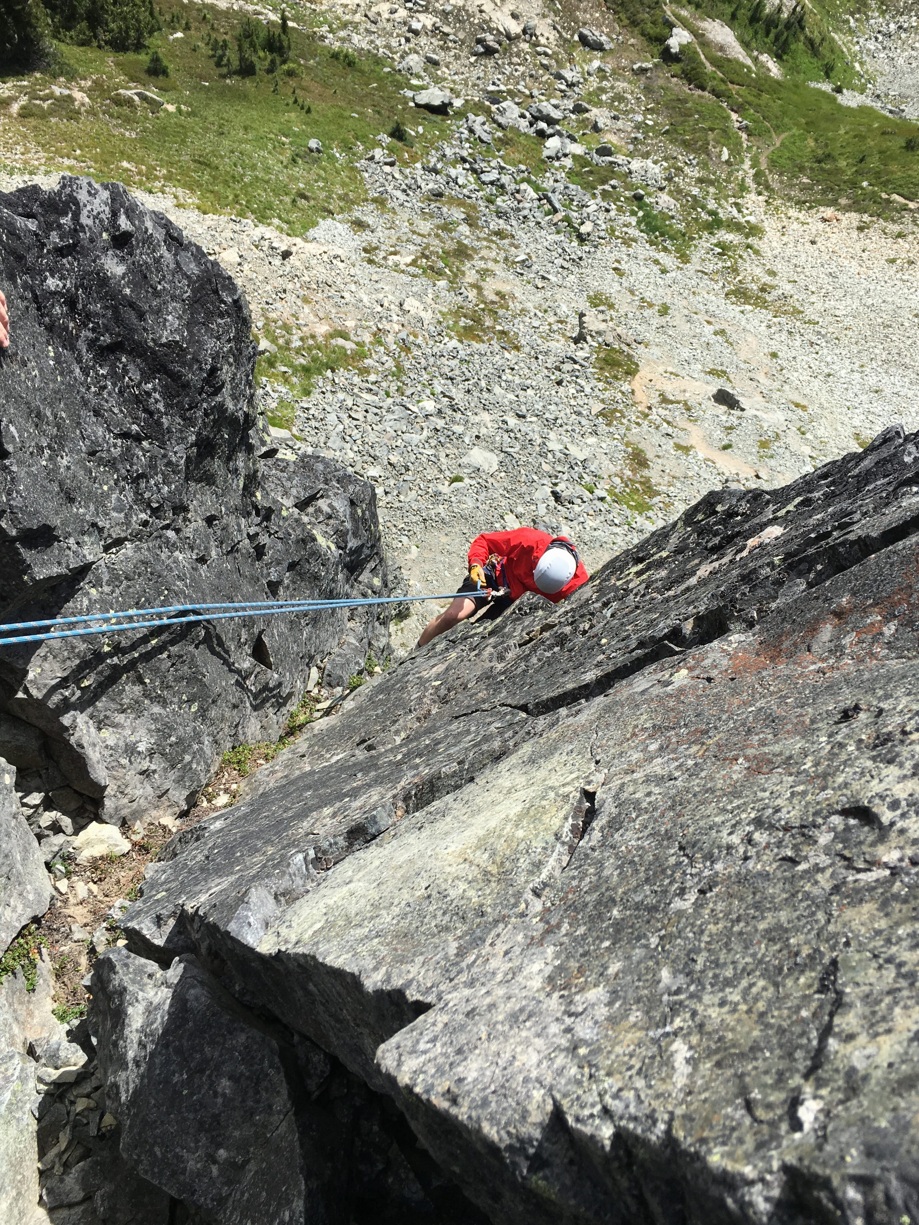
Jenny getting ready to climb South Early Winters Spire.
Jenny just before the difficult move on pitch 1.
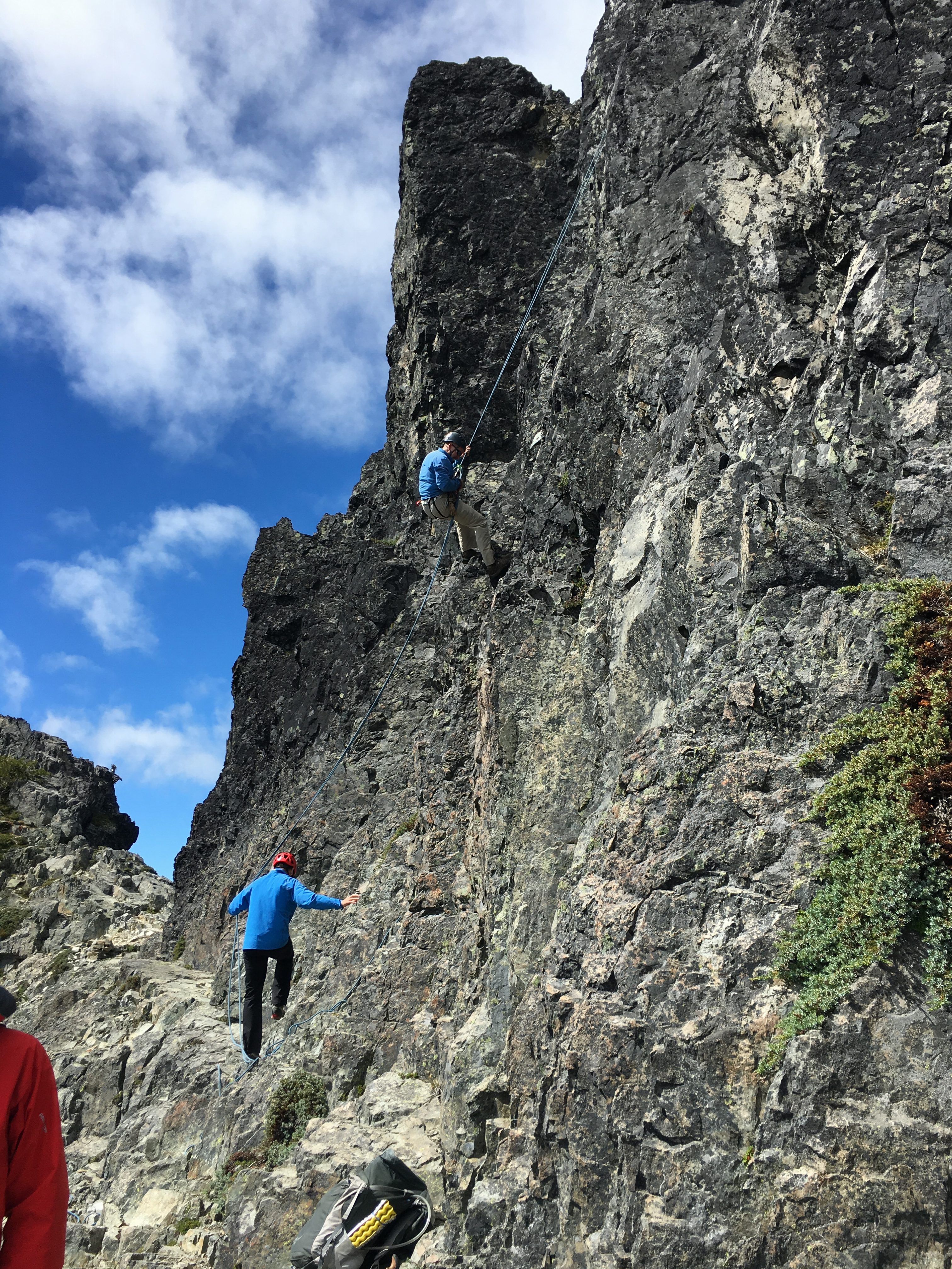
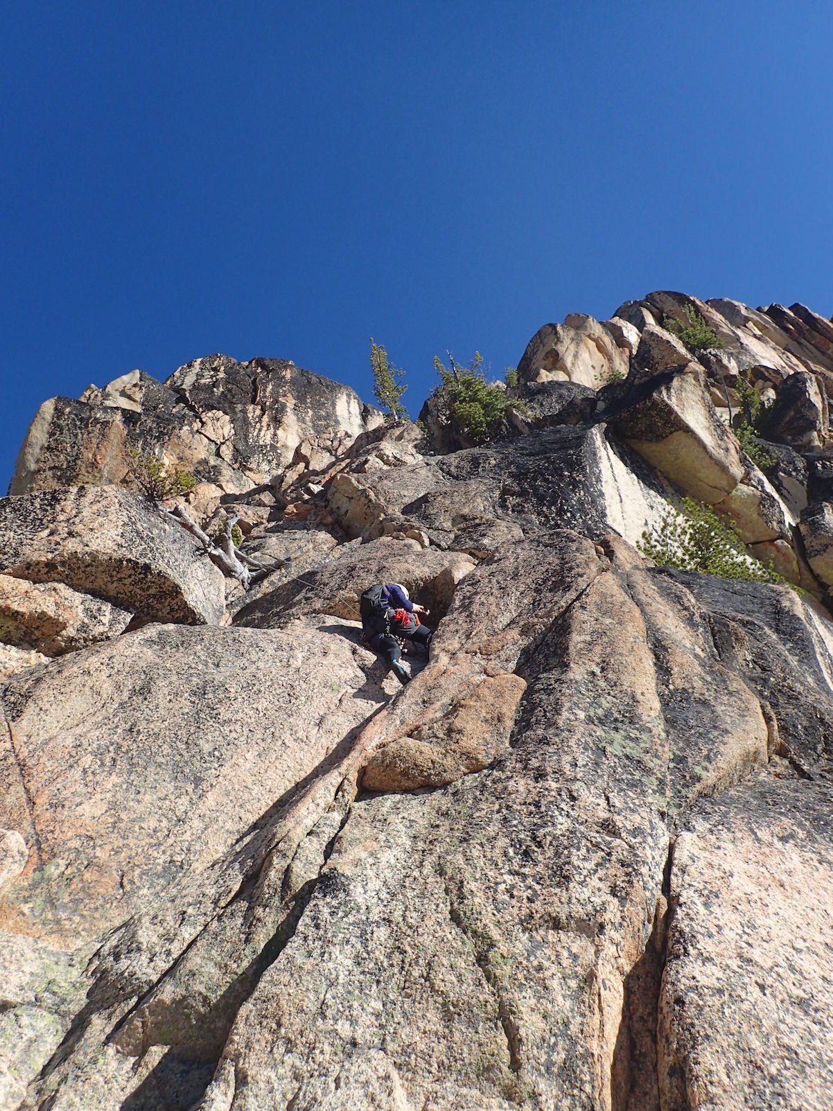
Michael, Martin and Jenny near the Whale’s Back, almost at the top of South Early Winters Spire.
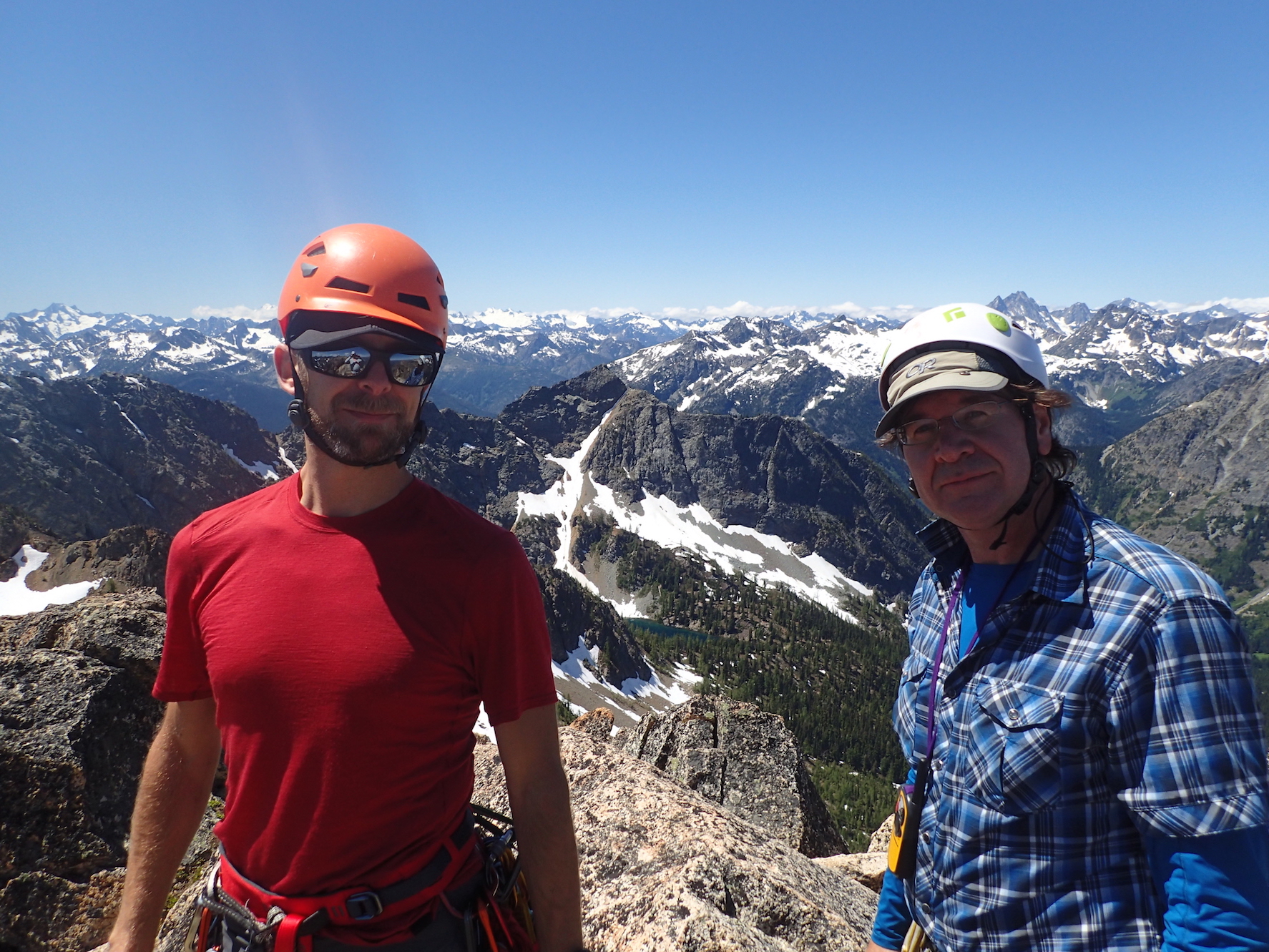
On the summit of South Early Winters Spire, with John and Michael.

View of North Early Winters Spire from the summit of South Early Winter Spire, high above the North Cascades Highway.
Another great day in the mountains, spent with amazing people.
On Friday, I started working on integrating my ConcJUnit changes into JUnit 4.12.
I had started that work at the end of 2014, but I never got around to finishing it.
The JUnit unit tests pass now, but there are a few quirks. In the past, I could put the concutest-junit-4.7-withrt.jar file as prefix on the boot classpath, but when I do that now, I get a strange NoClassDefFoundError: org.junit.internal.AssumptionViolatedException.
But I’ll continue to work on it. This time. Hopefully.
This cocktail worked out pretty well:
Madame Toulouse (2 servings)
For the peach simple syrup, I simmered one cup of water and one cup of sugar with a peach cut in pieces.

